Kenny Lake, Alaska
Kenny Lake is a farming community - one of the last to be homesteaded in America. Kenny Lake is a census-designated place (CDP) in Valdez-Cordova Census Area, Alaska, United States. At the 2010 census the population was 355, down from 410 in 2000.
Kenny Lake, Alaska | |
|---|---|
 Kenny Lake, Alaska Location within the state of Alaska | |
| Coordinates: 61°42′12″N 144°53′48″W | |
| Country | United States |
| State | Alaska |
| Census Area | Valdez-Cordova |
| Government | |
| • State senators | Click Bishop (R) Mike Dunleavy (R) |
| • State reps. | George Rauscher (R) Dave Talerico (R) |
| Area | |
| • Total | 195.2 sq mi (505.6 km2) |
| • Land | 195.0 sq mi (505.0 km2) |
| • Water | 0.2 sq mi (0.6 km2) |
| Elevation | 1,211 ft (369 m) |
| Population (2010) | |
| • Total | 355 |
| • Density | 1.8/sq mi (0.70/km2) |
| Time zone | UTC-9 (Alaska (AKST)) |
| • Summer (DST) | UTC-8 (AKDT) |
| Area code(s) | 907 |
| FIPS code | 02-38910 |
| GNIS feature ID | 1866955 |
Geography
Kenny Lake is located at 61°42′12″N 144°53′48″W (61.703384, -144.896546).[1]
According to the United States Census Bureau, the CDP has a total area of 195.2 square miles (506 km2), of which, 195.0 square miles (505 km2) of it is land and 0.2 square miles (0.52 km2) of it (0.12%) is water.
Demographics
| Historical population | |||
|---|---|---|---|
| Census | Pop. | %± | |
| 1990 | 423 | — | |
| 2000 | 410 | −3.1% | |
| 2010 | 355 | −13.4% | |
| U.S. Decennial Census[2] | |||
Kenny Lake first appeared on the 1990 U.S. Census as a census-designated place (CDP).
As of the census[3] of 2000, there were 410 people, 143 households, and 96 families residing in the CDP. The population density was 2.1 people per square mile (0.8/km²). There were 190 housing units at an average density of 1.0/sq mi (0.4/km²). The racial makeup of the CDP was 82.68% White, 10.24% Native American, 0.49% Asian, 2.68% from other races, and 3.90% from two or more races. 5.85% of the population were Hispanic or Latino of any race.
Of the 143 households 40.6% had children under the age of 18 living with them, 57.3% were married couples living together, 4.2% had a female householder with no husband present, and 32.2% were non-families. 27.3% of all households were made up of individuals and 9.8% had someone living alone who was 65 years of age or older. The average household size was 2.87 and the average family size was 3.52.
In the CDP, the age distribution of the population shows 32.4% under the age of 18, 6.6% from 18 to 24, 26.8% from 25 to 44, 24.6% from 45 to 64, and 9.5% who were 65 years of age or older. The median age was 36 years. For every 100 females, there were 113.5 males. For every 100 females age 18 and over, there were 116.4 males. There are also large numbers of wild geese.
The median income for a household in the CDP was $2, and the median income for a family was $2. Males had a median income of $40,938 versus $21,875 for females. The per capita income for the CDP was $13,121. About 22.7% of families and 25.9% of the population were below the poverty line, including 22.6% of those under age 18 and 11.8% of those age 65 or over.
References
- "US Gazetteer files: 2010, 2000, and 1990". United States Census Bureau. 2011-02-12. Retrieved 2011-04-23.
- "U.S. Decennial Census". Census.gov. Retrieved June 6, 2013.
- "U.S. Census website". United States Census Bureau. Retrieved 2008-01-31.
Municipalities and communities of Valdez–Cordova Census Area, Alaska, United States | ||
|---|---|---|
| Cities | 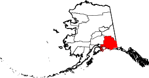 Valdez–Cordova Census Area map | |
| CDPs | ||
| Unincorporated communities | ||
| Ghost towns | ||