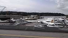
Kenmore Air Harbor
Kenmore Air Harbor[2] (IATA: KEH, FAA LID: S60) is a public-use seaplane base at the northern end of Lake Washington and 1 nmi (1.9 km; 1.2 mi) south of the central business district of Kenmore, Washington, U.S.[1][2] It primarily serves western Washington and parts of southwestern British Columbia. The base is primarily used by regional seaplane airline Kenmore Air.
Kenmore Air Harbor | |||||||||||||||
|---|---|---|---|---|---|---|---|---|---|---|---|---|---|---|---|
 | |||||||||||||||
| Summary | |||||||||||||||
| Airport type | Public | ||||||||||||||
| Owner | Gregg Munro | ||||||||||||||
| Serves | Kenmore, Washington | ||||||||||||||
| Location | Lake Washington | ||||||||||||||
| Elevation AMSL | 14 ft / 4 m | ||||||||||||||
| Coordinates | 47°45′17″N 122°15′33″W | ||||||||||||||
| Website | www.KenmoreAir.com | ||||||||||||||
| Runways | |||||||||||||||
| |||||||||||||||
| Statistics (2007) | |||||||||||||||
| |||||||||||||||
Facilities and aircraft
Kenmore Air Harbor covers an area of 5 acres (2.0 ha) at an elevation of 14 feet (4 m) above mean sea level. It has two seaplane landing areas: 16/34 is 10,000 by 1,000 feet (3,048 x 305 m) and 18/36 is 3,000 by 1,000 feet (914 x 305 m).[1]
For the 12-month period ending December 31, 2007, the airport had 48,300 aircraft operations, an average of 132 per day: 83% air taxi and 17% general aviation. At that time there were 60 single-engine aircraft based at this airport.[1]
Airlines and destinations
Passenger
In the arts
Kenmore Air Harbor is the base for the "San Juan Island Run" mission supplied with Microsoft Flight Simulator X.
References
- FAA Airport Master Record for S60 (Form 5010 PDF). Federal Aviation Administration. Effective 11 February 2010.
- Kenmore Air Harbor, City: Kenmore (Lake Washington), ID: S60 at Washington State DOT Airport Directory
External links
- Kenmore Air
- Aerial photo as of 10 July 1990 from USGS The National Map
- Resources for this airport:
- FAA airport information for S60
- AirNav airport information for S60
- ASN accident history for KEH
- FlightAware airport information and live flight tracker
- SkyVector aeronautical chart for S60