Bowers Airport
Bowers Field (IATA: ELN, ICAO: KELN, FAA LID: ELN) is a county-owned, public-use airport in Kittitas County, Washington, United States. It is located two nautical miles (4 km) north of the central business district of Ellensburg, Washington.[1] This airport is included in the National Plan of Integrated Airport Systems for 2011–2015, which categorized it as a general aviation facility.[2]
Bowers Field (former Ellensburg Army Airfield) | |||||||||||
|---|---|---|---|---|---|---|---|---|---|---|---|
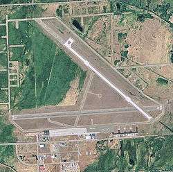
 USGS 2006 orthophoto | |||||||||||
| Summary | |||||||||||
| Airport type | Public | ||||||||||
| Owner | Kittitas County | ||||||||||
| Serves | Ellensburg, Washington | ||||||||||
| Elevation AMSL | 1,764 ft / 538 m | ||||||||||
| Coordinates | 47°01′59″N 120°31′50″W | ||||||||||
| Map | |||||||||||
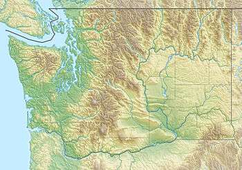
 ELN Location of airport in Washington | |||||||||||
| Runways | |||||||||||
| |||||||||||
| Statistics (2012) | |||||||||||
| |||||||||||
History
The airfield was established in 1943 as Ellensburg Army Airfield and manned by the 302d Base Headquarters and Air Base Squadron. Though planned as a fighter airfield for Fourth Air Force, it was taken over by Air Technical Service Command as a maintenance and supply depot, supporting transient Lend-Lease aircraft being flown to Alaska for subsequent transfer to the Soviet Union. The airfield had one auxiliary field, located at 47°06′39″N 120°37′58″W, which is now abandoned, though remains of a runway are still visible in aerial photography.
Military use ended in February 1945, and the airfield was turned over to War Assets Administration for subsequent transfer to Kittitas County for development into a civil airport.
Bowers Field is named in honor of Ensign Keith Bowers, the first man from Kittitas County killed in World War II. Bowers was at Pearl Harbor when it was attacked by the Japanese on December 7, 1941. The field became a training base for military pilots during the war.[3]
Established in 1975, Central Washington University's aviation program is the only fully accredited public university aviation program in the Pacific Northwest. More than 90 percent of the takeoffs and landings at Bowers Field are tied to Central Washington University's aviation program. Central Washington University took over hangar space and some fixed-base functions at Bowers Field last year. At the beginning of fall quarter, Central Washington University began hiring its own flight instructors, and started leasing and purchasing its own planes. The school earned its pilot school certification from the Federal Aviation Administration.
Today, large numbers of former aircraft dispersal areas are still maintained, along with an extensive system of taxiways with what appear to be modern aircraft shelters.
Facilities and aircraft
Bowers Field covers an area of 1,032 acres (418 ha) at an elevation of 1,764 feet (538 m) above mean sea level. It has one runways: 11/29 is 4,301 by 150 feet (1,311 x 46 m) with a concrete surface.[1] The former runway 7/25 was 5,590 by 150 feet (1,704 x 46 m) with an asphalt surface, but was permanently closed in June 2018.
For the 12-month period ending May 30, 2012, the airport had 60,445 aircraft operations, an average of 165 per day: 97% general aviation, 3% air taxi, and <1% military. At that time there were 48 aircraft based at this airport: 90% single-engine, 8% multi-engine, and 2% glider.[1]
References
- Sources

- Shaw, Frederick J. (2004), Locating Air Force Base Sites History's Legacy, Air Force History and Museums Program, United States Air Force, Washington DC, 2004.
- Notes
- FAA Airport Master Record for ELN (Form 5010 PDF). Federal Aviation Administration. Effective November 15, 2012.
- "2011–2015 NPIAS Report, Appendix A" (PDF). National Plan of Integrated Airport Systems. Federal Aviation Administration. October 4, 2010. Archived from the original (PDF, 2.03 MB) on 2012-09-27.
- "Kittitas County History." Kittitas County Historical Museum. N.p., n.d. Web. 12 August 2010. <http://www.kchm.org/history.asp> Archived July 26, 2011, at the Wayback Machine.
External links
- Bowers Field (ELN) at WSDOT Airport Directory
- Aerial image as of June 2000 from USGS The National Map
- FAA Terminal Procedures for ELN, effective August 13, 2020
- Resources for this airport:
- FAA airport information for ELN
- AirNav airport information for KELN
- ASN accident history for ELN
- FlightAware airport information and live flight tracker
- NOAA/NWS weather observations: current, past three days
- SkyVector aeronautical chart, Terminal Procedures