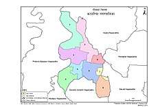
Katahariya
Katahariya is a Municipality in Rautahat District in the Narayani Zone of south-eastern Nepal since September 2017.Before September 2017, Katahariya was one of the Village Development Committees with 8 wards. In the time of the 1991 Nepal census it had a population of 4619 people living in 835 individual households.One of the famous temple of katahariya is Boudhimai temple.
Katahariya is famous for its vegetables and cattle market. It's also known as Katahariya Bazaar. It has a well-maintained Farmers' market(Vegetable) and Cattle(domestic-animal) market. Katahariya is a fast-growing VDC, the main occupations of local people being business and farming.
Katahariya became Municipality since September 2017 by merging different Gaupalika (previously VDCs)such as Hathiyahi, Birti Prastoka, Bhasedhawa, Bagahi, Pipra Pokhariya, etc. Now there are 9 wards in this Municipality.
In the recent local level election conducted on 18 Sep, 2017, Shiyaram Kushwaha (FIROZ) became the Mayor from Maoist party by winning from about 1200 more votes from Nepali congress.[2]
Katahariya कटहरिया | |
|---|---|
 Katahariya Location in Nepal | |
| Coordinates: 26.97°N 85.21°E | |
| Country | Nepal |
| Development Region | Central |
| Zone | Narayani |
| District | Rautahat District |
| Province | Province No. 2 |
| Government | |
| • Mayor | Siyaram Prasad Kuswaha |
| • Deputy Mayor | Nurjaha Khatun |
| Area | |
| • Total | 40.69 km2 (15.71 sq mi) |
| Population (2011)[1] | |
| • Total | 38,513 |
| • Density | 950/km2 (2,500/sq mi) |
| • Religions | Hindu, Muslim, Christian |
| Languages | |
| • Local | Maithili, Tharu, Nepali |
| Time zone | UTC+5:45 (NST) |
| Postal Code | 44500 |
| Area code(s) | 055 |
| Website | www.katahariyamun.gov.np |

Others development
- Campus and school
Shree Janta Higher Secondary School - Hospital
Area Health Post - Banks
Nepal Bank Limited - Katahariya Branch, Gramin Bikash Bank Ltd, Deprosc Laghubitta Bikas Bank Limited - Communication Networks
Nepal Telecom, Ncell and Other cellular network available are UTL Nepal, Smart Cell
References
- Nepal, Government of Nepal (November 2012). ""National Population and Housing Census 2011 (Village Development Committee/Municipality)" (PDF). National Planning Commission. Archived from the original (PDF) on 5 October 2018. Retrieved 16 December 2018.
- "Nepal Census 2001". Nepal's Village Development Committees. Digital Himalaya. Archived from the original on October 12, 2008. Retrieved 25 November 2008.
