Kasti, Maharashtra
Kashi is a panchayat village[2] in the state of Maharashtra, India,[3][4] on the left (east) bank of the Ghod River, across the river from the village of Tandali.[1][5] Administratively, Kasti is under Shrigonda Taluka of Ahmadnagar District in Maharashtra.[4] There is only the single village of Kasti in the Kashti gram panchayat.[4] The railroad station is 5 km by road south of the village. Kasti is 16 km by road southwest of the town of Shrigonda, and 14 km by road north of the town of Daund.
Kashti Kashti[1] | |
|---|---|
village | |
 Kashti Location in Maharashtra, India  Kashti Kashti (India) | |
| Coordinates: 18°32′57″N 074°34′56″E | |
| Country | |
| State | Maharashtra |
| District | Ahmadnagar |
| Taluka | Shrigonda |
| Government | |
| • Body | Village panchayat |
| Population (2011) | |
| • Total | 14,235 |
| Languages | |
| • Official | Marathi |
| Time zone | UTC+5:30 (IST) |
| ISO 3166 code | IN-MH |
| Website | www |
Demographics
In the 2001 census, the village of Kasti had 12,866 inhabitants, with 6,677 males (51.9%) and 6,189 females (48.1%), for a gender ratio of 927 females per thousand males.[6]
In the 2011 census, Kasti reported 14,235 inhabitants.[7]
Notes
- Kāshti (Approved) at GEOnet Names Server, United States National Geospatial-Intelligence Agency
- 2011 Village Panchayat Code for Kashti = 170063, "Reports of National Panchayat Directory: Village Panchayat Names of Shrigonda, Ahmadnagar, Maharashtra". Ministry of Panchayati Raj, Government of India. Archived from the original on 13 November 2011.
- 2001 Census Village code for Kasti = 03333600, "2001 Census of India: List of Villages by Tehsil: Maharashtra" (PDF). Registrar General & Census Commissioner, India. p. 647. Archived (PDF) from the original on 13 November 2011.
- 2011 Census Village code for Kasti = 558501, "Reports of National Panchayat Directory: List of Census Villages mapped for: Kashti Gram Panchayat, Shrigonda, Ahmadnagar, Maharashtra". Ministry of Panchayati Raj, Government of India. Archived from the original on 13 May 2013.
- Poona India, Sheet NE 43-06 (topographic map, scale 1:250,000), Series U-502, United States Army Map Service, May 1960
- "Census 2001 Population Finder: Maharashtra: Ahmadnagar: Shrigonda: Kasti". Office of The Registrar General & Census Commissioner, Ministry of Home Affairs, Government of India. Archived from the original on 13 May 2013.
- "NPR Report: Maharashtra: Ahmadnagara: Shrigonda". National Population Register, Ministry of Home Affairs, Government of India. 2011. Archived from the original on 13 May 2013.
gollark: Protocol μ is to be initiated.
gollark: <@319753218592866315> Consume apioforms.
gollark: Did palaiologos do apiocity?
gollark: What happened?
gollark: Utter idea: utterly replace all APIONET IRCds with https://github.com/oragono/oragono/ and lyricly demotion.
External links
Ahmednagar district topics | ||
|---|---|---|
| History | 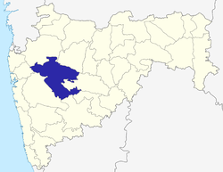 | |
| Geography | ||
| Talukas | ||
| Cities and towns | ||
| Monuments | ||
| Education |
| |
| Lok Sabha constituencies | ||
| Vidhan Sabha constituencies | ||
| Dams in District | ||
This article is issued from Wikipedia. The text is licensed under Creative Commons - Attribution - Sharealike. Additional terms may apply for the media files.