Kassala Airport
Kassala Airport (IATA: KSL, ICAO: HSKA) is an airport serving Kassala,[1][2] the capital city of the state of Kassala in Sudan.
Kassala Airport | |||||||||||
|---|---|---|---|---|---|---|---|---|---|---|---|
| Summary | |||||||||||
| Airport type | Public | ||||||||||
| Operator | Government | ||||||||||
| Serves | Kassala, Sudan | ||||||||||
| Elevation AMSL | 1,671 ft / 509 m | ||||||||||
| Coordinates | 15°23′14″N 036°19′43″E | ||||||||||
| Map | |||||||||||
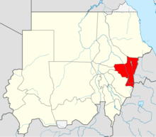 HSKA Location in Sudan (Kassala state highlighted) | |||||||||||
| Runways | |||||||||||
| |||||||||||
Facilities
The airport resides at an elevation of 1,671 feet (509 m) above mean sea level. It has one runway designated 02/20 with an asphalt surface measuring 2,500 by 45 metres (8,202 ft × 148 ft).[1]
Airlines and destinations
| Airlines | Destinations |
|---|---|
| Badr Airlines | Khartoum |
gollark: I'm preeeety sure potential negative consequences of something are relevant to that something.
gollark: Anyone who says they'll magically solve all possible problem probably won't.
gollark: As I said earlier, I mean, but apparently they'll just "deal with it" somehow?
gollark: This also seems like it could have problems like faked screenshots.
gollark: You would first have to define what you see as the actual problem.
References
- Airport information for HSKA from DAFIF (effective October 2006)
- Airport information for KSL at Great Circle Mapper. Source: DAFIF (effective October 2006).
This article is issued from Wikipedia. The text is licensed under Creative Commons - Attribution - Sharealike. Additional terms may apply for the media files.