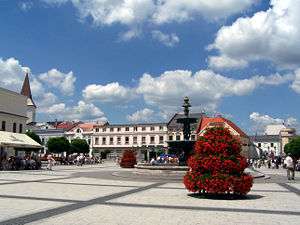
Karviná District
Karviná District (Czech: okres Karviná, Polish: powiat Karwina) is a district (okres) within the Moravian-Silesian Region of the Czech Republic. Its administrative center is the city of Karviná. It was created by 1960 reform of administrative divisions in the area of former Fryštát District. Karviná District is part of Czech Silesia.
Karviná District Okres Karviná | |
|---|---|
 | |
District location in the Moravian-Silesian Region within the Czech Republic | |
| Country | Czech Republic |
| Region | Moravian-Silesian |
| Capital | Karviná |
| Area | |
| • Total | 356.24 km2 (137.55 sq mi) |
| Population (2019-01-01[1]) | |
| • Total | 247,887 |
| • Density | 700/km2 (1,800/sq mi) |
| Time zone | UTC+1 (CET) |
| • Summer (DST) | UTC+2 (CEST) |
| Municipalities | 17 |
| * Cities and towns | 7 |
| * Market towns | 0 |
| * Villages | 10 |
The Karviná District is facing a fast population decline. The population decrease between 2010 and 2019 was 23,445 people (8,6 %).
Complete list of municipalities
Albrechtice – Bohumín – Český Těšín – Chotěbuz – Dětmarovice – Dolní Lutyně – Doubrava – Havířov – Horní Bludovice – Horní Suchá – Karviná – Orlová – Petrovice u Karviné – Petřvald – Rychvald – Stonava – Těrlicko
gollark: V is so amazing it doesn't NEED an AST, which is why the compiler does 2.7GLoC/s.
gollark: V would be great if it wasn't a lie and also filled with bad stuff from Go.
gollark: Lua?
gollark: ```nim let html = buildHtml(table(class="rev-table")): tr: th: text "Time" th: text "Changes" th: text "Size" th: text "Words" for rev in revs: tr: td(class="ts"): a(href=ctx.urlFor("view-page", { "page": encodeUrl(page) }, { "ts": domain.timestampToStr(rev.time) })): text displayTime(rev.time) td: text rev.meta.editDistance.map(x => $x).get("") td: text rev.meta.size.map(x => formatSize(x)).get("") td: text rev.meta.words.map(x => $x).get("")```I mean, this is perfect and without flaw.
gollark: I somewhat agree, although it would worsen the aesthetics of the HTML I have in my thing.
References
- "Population of municipalities of the Czech republic". Czech Statistical Office. Retrieved 2019-04-30.
This article is issued from Wikipedia. The text is licensed under Creative Commons - Attribution - Sharealike. Additional terms may apply for the media files.