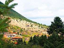
Kardaras
Kardaras (Greek: Καρδαράς) is a mountain village in the municipal unit of Levidi, Arcadia, Greece. It is situated in the eastern foothills of the Mainalo mountains, at 1,030 m elevation and is considered a traditional settlement. As of 2011, it had a population of 20. It is 5 km northwest of Kapsas, 6 km south of Levidi, 6 km east of Alonistaina and 15 km northwest of Tripoli. The Greek National Road 74 (Tripoli - Olympia - Pyrgos) passes east of the village.
Kardaras Καρδαράς | |
|---|---|
 | |
 Kardaras | |
| Coordinates: 37°37.7′N 22°17.7′E | |
| Country | Greece |
| Administrative region | Peloponnese |
| Regional unit | Arcadia |
| Municipality | Tripoli |
| Municipal unit | Levidi |
| Highest elevation | 1.035 m (3.396 ft) |
| Lowest elevation | 1.030 m (3.379 ft) |
| Community | |
| • Population | 20 (2011) |
| Time zone | UTC+2 (EET) |
| • Summer (DST) | UTC+3 (EEST) |
| Vehicle registration | TP |
Population
| Year | Population |
|---|---|
| 1981 | 5 |
| 1991 | 88 |
| 2001 | 47 |
| 2011 | 20 |
gollark: It's called livEGPS.
gollark: I did this ages ago for ironic purposes.
gollark: So incorrect ones? Great*!
gollark: Strings on the GPS channel? This will do nothing whatsoever.
gollark: Incorrect positions? That would be bad.
External links
References
- "Απογραφή Πληθυσμού - Κατοικιών 2011. ΜΟΝΙΜΟΣ Πληθυσμός" (in Greek). Hellenic Statistical Authority.
This article is issued from Wikipedia. The text is licensed under Creative Commons - Attribution - Sharealike. Additional terms may apply for the media files.