Kala Chitta Range
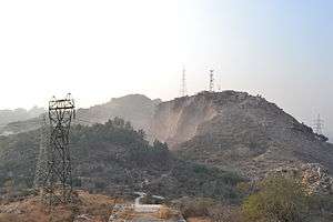
Kala Chitta Range (in Punjabi and Urdu: کالا چٹا Kālā Chiṭṭā) is a mountain range in the Attock District of Punjab, Pakistan. Kala- Chitta are Punjabi words meaning Kala the Black and Chitta means the white. The range thrusts eastward across the Potohar plateau towards Rawalpindi.[1]
| Kala Chitta | |
|---|---|
 | |
| Highest point | |
| Elevation | 841 m (2,759 ft) |
| Coordinates | 33°43′N 72°10′E |
| Naming | |
| Native name | کالا چٹا (Punjabi) |
| Geography | |
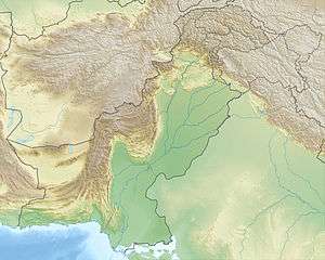  Kala Chitta | |
| Country | Pakistan |
| Provinces | Punjab and Khyber Pakhtunkhwa |
Notes
- "The Salt Range and Potwar Plateau". Plains and Plateaus of Pakistan. Pakistan Paedia. Retrieved 6 August 2012.
Punjab geography | ||
|---|---|---|
|  | |
This article is issued from Wikipedia. The text is licensed under Creative Commons - Attribution - Sharealike. Additional terms may apply for the media files.