Kaimanawa Range
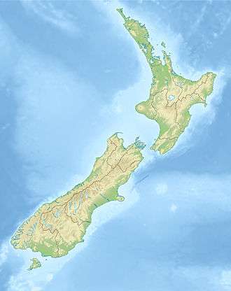
The Kaimanawa Range of mountains (often known as the Kaimanawas) is located in the central North Island of New Zealand. They extend for 50 kilometres in a northeast/southwest direction through largely uninhabited country to the south of Lake Taupo, east of the "Desert Road". Their slopes form part of the North Island Volcanic Plateau.[2]
| Kaimanawa Range | |
|---|---|
 Kaimanawa Range | |
| Highest point | |
| Elevation | 1,727 m (5,666 ft) [1] |
The New Zealand Ministry for Culture and Heritage gives a translation of "breath for food" for Kaimanawa.[3]
The lands around the mountains are scrubby. To the west, where the Rangipo Desert is located, the soils are poor quality. To the east, the soils are more fertile, but the land is very rough. A feral horse, the Kaimanawa horse. roams free on the ranges.
Unlike the majority of mountain ranges in New Zealand, the Kaimanawa Range is divided into private land. Considerable areas of the Rangipo Desert are used by the New Zealand Army for training.
Kaimanawa Wall

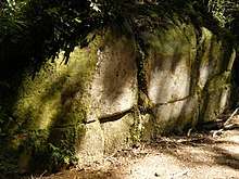
Within the Kaimanawa State Forest area is the Kaimanawa Wall.[4][5]
The Tuwharetoa tangata whenua claim an “oral tradition” of the place as a kōhatu (rock).[4] A popular theory is that the wall is a human construction.[4] From that popular theory, a pseudoscience theory explains the wall as a pre-Māori civilization artifact.[4]
The wall formation was inspected by an anthropologist and a geologist; neither saw evidence of a human origin. In a preliminary investigation, anthropologist Neville Ritchie of the New Zealand Department of Conservation, observed "matching micro-irregularities along the joints." This indicated that the blocks in the wall were too perfectly matched. He also observed the joints were neither straight nor truly horizontal nor perpendicular, indicating the joint alignments were too poorly constructed.
Ritchie concluded the blocks are a natural formation based on the presence of matching micro-irregularities in blocks and imperfect joint alignment.[4]
Peter Wood, of the Institute of Geological and Nuclear Sciences at Wairakei, inspected the blocks for an afternoon and concluded they are natural fractures in what Wood termed "Jointed-Rangitaiki-Ignimbrite," and described as "330,000 year old volcanic rock that is common in the Taupo Volcanic Zone."[4] Both vertical and horizontal joints are common. Fractures in the Rangitaiki ignimbrite formed when it cooled and contracted after flowing into place during an eruption.[4]
References
- https://www.mountain-forecast.com/peaks/Makorako
- "Place name detail: KAIMANAWA MOUNTAINS". New Zealand Gazetteer. Land Information New Zealand. Retrieved 2010-04-17.
- "1000 Māori place names". New Zealand Ministry for Culture and Heritage. 6 August 2019.
- "A New Age Myth: the Kaimanawa Wall". NZ Skeptics. Retrieved 30 October 2018.
- Howe, K.R. "Ideas of Māori origins - 1920s–2000: new understanding". Te Ara - The Encyclopedia of New Zealand. Retrieved 13 January 2019.