Joutsa
Joutsa is a municipality of Finland. It is located in the province of Western Finland and is part of the Central Finland region. Jyväskylä is located about 70 kilometres (43 mi) north of the Joutsa municipality.
Joutsa | |
|---|---|
Municipality | |
| Joutsan kunta Joutsa kommun | |
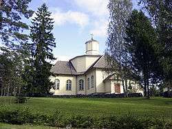 Joutsa Church | |
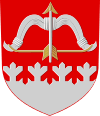 Coat of arms | |
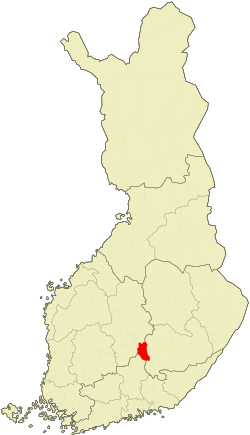 Location of Joutsa in Finland | |
| Coordinates: 61°44.5′N 026°07′E | |
| Country | |
| Region | Central Finland |
| Sub-region | Joutsa sub-region |
| Government | |
| • Municipal manager | Harri Nissinen |
| Area (2018-01-01)[1] | |
| • Total | 1,066.42 km2 (411.75 sq mi) |
| • Land | 867.17 km2 (334.82 sq mi) |
| • Water | 199.25 km2 (76.93 sq mi) |
| Area rank | 89th largest in Finland |
| Population (2019-01-31)[2] | |
| • Total | 4,459 |
| • Rank | 188th largest in Finland |
| • Density | 5.14/km2 (13.3/sq mi) |
| Population by native language | |
| • Finnish | 98.9% (official) |
| • Swedish | 0.2% |
| • Others | 0.9% |
| Population by age | |
| • 0 to 14 | 12.6% |
| • 15 to 64 | 60.2% |
| • 65 or older | 27.2% |
| Time zone | UTC+02:00 (EET) |
| • Summer (DST) | UTC+03:00 (EEST) |
| Municipal tax rate[5] | 19.5% |
| Website | www.joutsa.fi |
The municipality has a population of 4,459 (31 January 2019)[2] and covers an area of 1,066.42 square kilometres (411.75 sq mi) of which 199.25 km2 (76.93 sq mi) is water.[1][1] The population density is 5.14 inhabitants per square kilometre (13.3/sq mi).
Neighbouring municipalities: Hartola, Hirvensalmi, Jyväskylä, Kangasniemi, Luhanka, Pertunmaa and Toivakka. Municipality of Leivonmäki was consolidated with Joutsa on January 1, 2008.
The municipality is unilingually Finnish.
Nature and Culture
There are all together 192 lakes in Joutsa. Biggest lakes are Puula, Suontee and Jääsjärvi.[6]
Leivonmäki National Park is located in Joutsa. At area is swamps, beaches and forest in esker.
Newspapers:
- Joutsan seutu is published in Joutsa and Luhanka.
- Itä-Häme
Sahticulture in Joutsa is known by Joutsan sahti.
Some villages
Havumäki, Kivisuo, Kälä, Laitjärvi, Lapinkylä, Leivonmäki, Marjotaipale, Pärnämäki, Ruokoranta, Ruorasmäki, Rutalahti, Savenaho, Selänpohja, Taka-Ikola, Tammilahti, Tolvasniemi, and Vehmaa
Gallery
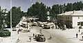 Joutsa bus station in the late 1950s
 Lake Suontee in Joutsa
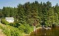 Suontee
 Forest at Leivonmäki
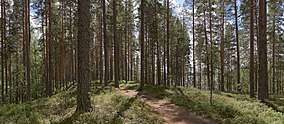 Forest at Leivonmäki
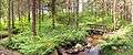 Koskikara nature trail
 Joutsansalmi (Joutsan strait)
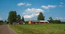 A village in Leivonmäki
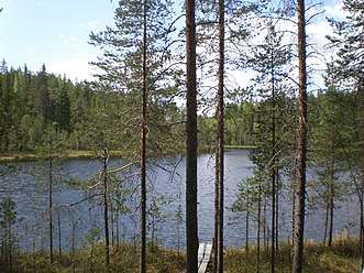 Soimalampi
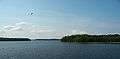 Lake Suontee from Marjotaipaleentie
Twinnings

References
- "Area of Finnish Municipalities 1.1.2018" (PDF). National Land Survey of Finland. Retrieved 30 January 2018.
- "Suomen virallinen tilasto (SVT): Väestön ennakkotilasto [verkkojulkaisu]. Tammikuu 2019" (in Finnish). Statistics Finland. Retrieved 15 March 2019.
- "Population according to language and the number of foreigners and land area km2 by area as of 31 December 2008". Statistics Finland's PX-Web databases. Statistics Finland. Retrieved 29 March 2009.
- "Population according to age and gender by area as of 31 December 2008". Statistics Finland's PX-Web databases. Statistics Finland. Retrieved 28 April 2009.
- "List of municipal and parish tax rates in 2011". Tax Administration of Finland. 29 November 2010. Retrieved 13 March 2011.
- "Joutsa". Järviwiki. Finland's Environmental Administration. 2012. Retrieved 27 February 2012.
- "Suomen kuntien ystävyyskunnat" (in Finnish). Embassy of Finland in Estonia. Retrieved 7 May 2012.
- "Ystävyyskunnat" (PDF) (in Finnish). Pohjola-Norden. Retrieved 7 May 2012.
External links
![]()
- Municipality of Joutsa – Official website, finnish
| Municipalities | ||
|---|---|---|
| Former municipalities |
| |
| ||