Joseph Fischer (cartographer)
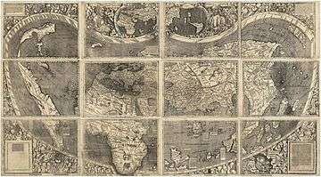
Joseph Fischer, S.J. (German: Josef Fischer; 19 March 1858 – 26 October 1944) was a German clergyman and cartographer. Fischer had an eminently successful career as a cartographer, publishing old maps. In 1901, while he was investigating the Vikings' discovery of America, he accidentally discovered the long-lost map of Martin Waldseemüller, dated 1507. This map, which claims to update Ptolemy with the voyages of Amerigo Vespucci, is the first known to display the word America.[1] The map was purchased from its owner by the United States Library of Congress in 2001 for ten million dollars.[2][3]


Biography
Early life and education
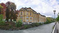
Fischer was born in Quadrath (Rhineland), son of Gustav Fischer (1826-1890) and Elizabeth (1819-1902).[1] He was educated at the gymnasium in Rheine and the universities of Münster, Munich, Innsbruck and Vienna, and Jesuit scholasticates in the Netherlands, Austria and England. In 1881, he entered the Society of Jesus and was ordained to the priesthood in 1891. After 1895, he was professor of geography and history at Stella Matutina College, Feldkirch, Austria,[4] where he taught until 1938.[5]
Cartographer
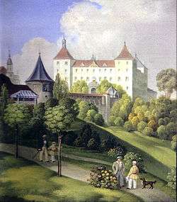
Fischer's research encompassed Western geography and cartography from antiquity to early modern times. His special focus was on the maps of Ptolemy and Martin Waldseemüller. His scientific achievements comprise the discoveries, starting in 1891, of the maps of Martin Waldseemüller of 1507 and 1516, and of Jodocus Hondius in Schloss Wolfegg, Württemberg. In 1903-04, and again in 1909-10, he visited Italy, France and England as a member of the Austrian Institute of Historical Studies for the purpose of cartographical research.[4] After Stella Matutina College was closed by the Nazis in 1938, Fischer moved to Munich and afterwards in 1941 to Schloss Wolfegg, where he oversaw the archives until his death.[6]
Awards and recognition
He was a recognized writer and won numerous awards at home and abroad: he was a member of the Austrian Academy of Sciences, of the Pontifical Academy of Archaeology, honorary member of the Royal Geographical Society, fellow of the American Geographical Society, awarded the Carl Ritter Silver Medal of the Geographical Society of Berlin (1933), and he received an honorary doctorate from the University of Innsbruck (1935).[1] Fischer wrote a number of articles for the Catholic Encyclopedia..[7]
Vinland Map
Fischer’s knowledge of history, cartography and palaeography were the reasons that Norwegian-American writer and historian Kirsten A. Seaver considered him one of the candidates to have forged the Vinland Map. This world map, which emerged in 1957, is supposedly a pre-Columbian map that shows a portion of North America (Vinland); the authenticity of the map has been questioned by many and Seaver’s investigation concluded that Fischer was the most probable author of the map.[6] However, subsequent research into the provenance of the Vinland map documents suggests that they are unlikely to have spent any time in Fischer's possession. Robert Baier, a forensic handwriting analyst, examined the map text and correspondence of Fisher, and his opinion was that “they are not the same writer.”[8]
Writings
His published works include:[4]
- Die Beziehungen Kaiser Rudolfs II zu Erzherzog Matthias bis zum Vertrage von Lieben
- Der sogennante Schottwiener Vertrag vom Jahre 1600 (1897)
- Der Linzer Tag vom Jahre 1605 in seiner Bedeutung für die Österreichische Haus und Reichsgeschichte (1898)
- Fischer, Joseph (1902). Die Entdeckungen der Normannen in America: Unter besonderer berücksichtigung der kartographischen darstellungen. Ergänzungshefte zu den 'Stimmen aus Maria-Laach' no. 81 (in German). Freiburg im Breisgu [etc.]: Herder.CS1 maint: ref=harv (link)
- Fischer, Joseph; Soulsby, Basil H. (Basil Harrington) (1903). The discoveries of the Norsemen in America: with special relation to their early cartographical representation. London: Henry Stevens, son, & Stiles.CS1 maint: ref=harv (link)
- Die älteste Karte mit dem Namen America A.D. 1507, und die Carta Marina aus dem Jahre 1516 des M. Waldseemüller (German and English eds., 1903)
- Hondius, Jodocus (1907) [1611]. Stevenson, Edward Luther; Fischer, Joseph (eds.). Map of the World. New York: American Geographical Society of New York; Hispanic Society of America.CS1 maint: ref=harv (link)
- Waldseemüller, Martin; Herbermann, Charles George; Fischer, Joseph; Wieser, Franz, Ritter von; Burke, Edward (1907). The Cosmographiae introductio of Martin Waldseemüller in facsimile: followed by The four voyages of Amerigo Vespucci, with their translation into English; to which are added Waldseemüller's two world maps of 1507. New York: The United States Catholic Historical Society.CS1 maint: ref=harv (link)
- Ptolemaeus, Claudius; Fischer, Joseph (1910). Der "deutsche Ptolemäus" aus dem ende des XV. jahrhunderts (um 1490) in faksimiledruck. Hrsg. mit einer einleitung von Jos. Fischer, S. J. (in German). Strassburg: Heitz & Mündel.CS1 maint: ref=harv (link)
He collaborated in Jahrbuch des historischen Vereins von Liechtenstein (1910) and contributed to the Innsbrucker theologische Zeitschrift, Innsbrucker Fernandeums Zeitschrift, Historical Records and Studies, Göttinger Gelehrte Anzeigen, The Catholic Encyclopedia, and Stimmen aus Maria-Laach.[4]
Notes
- Straßenberger SJ, Georg (1961). "Fischer, Josef.". Neue Deutsche Biographie (NDB) (in German). 5. Berlin: Duncker & Humblot. pp. 194–195. ISBN 978-3-428-00186-6. Retrieved 19 April 2016.
- The Map That Named America, Library of Congress, September 2003
- "Library of Congress Acquires Only Known Copy of 1507 World Map Compiled by Martin Waldseemüller", Library of Congress, 2001-07-23
- Rines 1920.
- "Obit. Joseph Fischer, S.J.". Isis: A Journal of the History of Science Society. 37 (3/4): 183. July 1947. doi:10.1086/348025.
- Harvey, P. D. A. (18 Jul 2006). "The Vinland Map, R. A. Skelton and Josef Fischer". Imago Mundi. The International Journal for the History of Cartography. 58 (1): 95–99. doi:10.1080/03085690500362629.
- The Catholic Encyclopedia and its Makers, 1917, p. 57
- "The Viking Map". Secrets. Season 1. Episode 5. 2013. Smithsonian Channel.
References
| Wikisource has original works written by or about: Joseph Fischer |
- This article incorporates text from a publication now in the public domain: Rines, George Edwin, ed. (1920). . Encyclopedia Americana.