Jhalokati District
Jhalokathi (Bengali: ঝালকাঠি) is a district in southern Bangladesh.[2] It is located in the Barisal Division and covers an area of 758.06 km2 It is bounded by Barisal district to the north and east, Barguna district and the Bishkhali river in the south, Lohagara Upazila and Pirojpur district to the west. Annual average temperatures: maximum 33.3 °C, minimum 12.1 °C; annual rainfall 2506 mm. Main rivers in this district are Bishkhali, Sugandha, Dhanshiri, Gabkhan, Jangalia and Bamanda, Bajitpur River. "পেয়ারা আর শীতলপাটি এই নিয়ে ঝালকাঠি" is the district branding.[3]
Jhalokati ঝালকাঠি | |
|---|---|
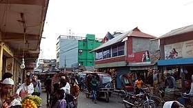 .jpg) .jpg) 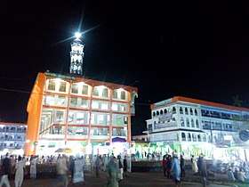 From top: Jhalokati Sadar Road, Kirtipasha Zamindar Bari Ruins and Jhalokathi N S Kamil Madrasah Complex | |
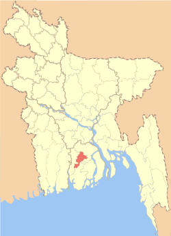 Location of Jhalokati in Bangladesh | |

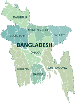
Expandable map of Jhalokati District | |
| Coordinates: 22.6431°N 90.2000°E | |
| Country | |
| Division | Barisal Division |
| Area | |
| • Total | 758.06 km2 (292.69 sq mi) |
| Population (2011 census) | |
| • Total | 694,090 |
| • Density | 920/km2 (2,400/sq mi) |
| Time zone | UTC+06:00 (BST) |
| HDI (2018) | 0.672[1] medium · 2nd of 21 |
| Website | www |
Subdivisions
The district is administratively subdivided into 4 upazilas, these are:
Administration
Administrator of Zila Porishad: Sarder Mohammad Shah Alam [4]
Transportation
- Roads & Highways:
- Rural communications: Water transport is a major attraction in Jhaokati district. People can travel at a cheap cost by boats and various types of engine boats. Jhalokati is famous for beautiful rivers and canals like Barishal. Tourists can find it enjoyable to travel through boats.
Population[7]
- Total population: 694,090
- Male: 346,161
- Female: 347,929
Religion
The district of Jhalokati consists 2475 mosques Dubious – 3 mosques for every km2?, 46 temples and five Buddhist temples.
Media
Print media:
- Prothom Alo (National)
- Kaler kantho (National)
- Daily Samakal (National)
- The Daily Star (National)
Satellite Television:
- TATA Sky.
References
| Wikimedia Commons has media related to Jhalokati District. |
- "Sub-national HDI - Area Database - Global Data Lab". hdi.globaldatalab.org. Retrieved 2020-03-18.
- Rahman, Humayun (2012). "Jhalokati District". In Islam, Sirajul; Jamal, Ahmed A. (eds.). Banglapedia: National Encyclopedia of Bangladesh (Second ed.). Asiatic Society of Bangladesh.
- "District Branding". Jhalokati District.
- "AL men appointed administrators". The Daily Star. December 16, 2011.
- "List of Deputy Commissioners". Ministry of Public Administration.
- "Officers: Deputy Commissioner's Office".
- "District Branding". Jhalokati District.
| Upazila/Thana: | ||
|---|---|---|
| Barisal Division |
|  |
|---|---|---|
| Chittagong Division | ||
| Dhaka Division | ||
| Khulna Division | ||
| Mymensingh Division | ||
| Rajshahi Division | ||
| Rangpur Division | ||
| Sylhet Division | ||
| Wikivoyage has a travel guide for Jhalokati District. |