Jhabrera
Jhabrera is a town and a nagar panchayat in Hardwar district in the Indian state of Uttarakhand, situated 17 kilometres from Roorkee. It can be reached by taking a left turn before Ganga canal and while entering Manglaur town from Delhi.
Jhabrera | |
|---|---|
city | |
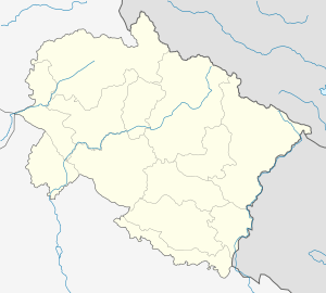
 Jhabrera Location in Uttarakhand, India  Jhabrera Jhabrera (India) | |
| Coordinates: 29.809°N 77.775°E | |
| Country | India |
| State | Uttarakhand |
| District | Haridwar |
| Area | |
| • Total | 0.9 km2 (0.3 sq mi) |
| Elevation | 260 m (850 ft) |
| Population (2001) | |
| • Total | 9,378 |
| • Density | 10,000/km2 (27,000/sq mi) |
| Languages | |
| • Official | Hindi |
| Time zone | UTC+5:30 (IST) |
| Vehicle registration | UK |
| Website | 210 |
jhabreda state
The town gets its name from the former village of "Jhabar Hera", established by Rao Bah Mal, a ‘zamindar’(Descendant Jograj Singh Panwar commander of Sarvakhap who fought Timur Lung in 1398),during the reign of Mughal Emperor Shahjahan.[1] jhabreda is a old gurjar Riyasat founded by gurjar king Chaudhary Jhabar Singh from where it got its name " jhabreda"
Demographics
As of 2001 India census,[2] Jhabrera had a population of 9378. Males constitute 53% of the population and females 47%. Jhabrera has an average literacy rate of 57%, lower than the national average of 59.5%: male literacy is 65%, and female literacy is 48%. In Jhabrera, 18% of the population is under 6 years of age.
Important Places
Raja Rao Bahmal Gurjar Haveli Campus.
Chaudhary Bharat Singh DAV college(Gurjar).
Jhabrera haat
Agarwal Dharamshala
Chaudhary Charat Dham Mandir
Jain Mandir
Shahi Masjid
Kali Temple
Akhada Mandir
Baba Bahmal Mandir
Jabarhera Mango Research Farm
Rajwada Farm House
Amar Jawan chowk
Indian flag chowk
Shiv chowk
See also
- Ambition Public School, located in Jhabrera
References
- Introduction
- "Census of India 2001: Data from the 2001 Census, including cities, villages and towns (Provisional)". Census Commission of India. Archived from the original on 16 June 2004. Retrieved 1 November 2008.
Sahranpur district Gajetiar