Mohanpur Mohammadpur
Mohanpur Mohammadpur is a census town in Haridwar district in the Indian state of Uttarakhand.
Mohanpur Mohammadpur | |
|---|---|
Southern suburb of Roorkee city | |
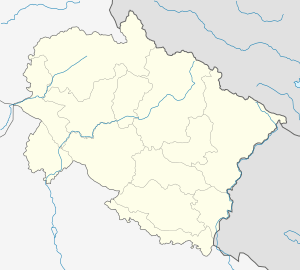
 Mohanpur Mohammadpur Location in Uttarakhand, India  Mohanpur Mohammadpur Mohanpur Mohammadpur (India) | |
| Coordinates: 29.78°N 77.97°E | |
| Country | |
| State | Uttarakhand |
| District | Haridwar |
| Elevation | 240 m (790 ft) |
| Population (2011) | |
| • Total | 9,300 |
| Languages | |
| • Official | Hindi |
| Time zone | UTC+5:30 (IST) |
| Vehicle registration | UK |
| Website | uk |
Geography
Mohanpur Mohammadpur is located at 29.78°N 77.97°E.[1] It has an average elevation of 240 metres (787 feet). It constitutes of two villages one is Mohammadpur inhabitant of Muslim Gada community, other is Mohanpura inhabitant of Hindu Gadariya (Pal) community.
Demographics
As of 2001 India census,[2] Mohanpur Mohammadpur had a population of 9300. Males constitute 52% of the population and females 48%. Mohanpur Mohammadpur has an average literacy rate of 71%, higher than the national average of 59.5%: male literacy is 75%, and female literacy is 59%. In Mohanpur Mohammadpur, 14% of the population is under 6 years of age.
gollark: I listen to the girl, d6.
gollark: OH BEE
gollark: ++data inc xp
gollark: I search the goblin for business cards or tribal affiliations, d6.
gollark: LyricLy can set the difficulty very high.
References
- Falling Rain Genomics, Inc - Mohanpur Mohammadpur
- "Census of India 2001: Data from the 2001 Census, including cities, villages and towns (Provisional)". Census Commission of India. Archived from the original on 16 June 2004. Retrieved 1 November 2008.
This article is issued from Wikipedia. The text is licensed under Creative Commons - Attribution - Sharealike. Additional terms may apply for the media files.