Jibbain
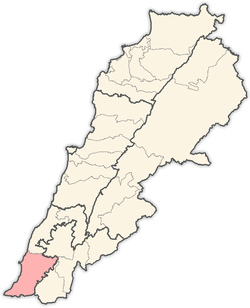
Jibbain (Arabic: الجبين) is a municipality in Southern Lebanon, located in Tyre District, Governorate of South Lebanon.
Jibbain الجبين Jebbayn, Jebbine | |
|---|---|
 Jibbain Location within Lebanon | |
| Coordinates: 33°7′23″N 35°14′0″E | |
| Grid position | 172/280 PAL |
| Country | |
| Governorate | South Lebanon Governorate |
| District | Tyre District |
| Time zone | UTC+2 (EET) |
| • Summer (DST) | UTC+3 (EEST) |
Name
According to E. H. Palmer, the name means "the two pits".[1]
History
In 1596, it was named as a village, Jibin, in the Ottoman nahiya (subdistrict) of Tibnin under the liwa' (district) of Safad, with a population of 7 households, all Muslim. The villagers paid a fixed tax-rate of 25 % on agricultural products, such as wheat, barley, olive trees, goats, beehives; in addition to occasional revenues and a press for olive oil or grape syrup; a total of 2,177 akçe.[2][3]
In 1875 Victor Guérin noted here "a few Metawileh families", who inhabited an ancient locality.[4]
In 1881, the PEF's Survey of Western Palestine (SWP) described it: "A small village, built of stone, containing about seventy Metawileh; it is situated on a hill, with figs, olives, and arable land around. There are three cisterns for water."[5] They further noted a ruined, rock-cut birket.[6]
Modern era
On August 3 or 4, 2006, during the 2006 Lebanon War, Israeli helicopter strikes killed 4 Hezbollah operatives in an uninhabited valley some 900 meters from Jibbain. At the same time they fired on the house nearest, killing 4 civilians, aged 42 to 81 years of age.[7]
References
- Palmer, 1881, p. 43
- Hütteroth and Abdulfattah, 1977, p. 180
- Note that Rhode, 1979, p. 6 writes that the register that Hütteroth and Abdulfattah studied was not from 1595/6, but from 1548/9
- Guérin, 1880, p. 130
- Conder and Kitchener, 1881, SWP I, p. 151
- Conder and Kitchener, 1881, SWP I, p. 169
- HRW, 2007, pp. 129-130
Bibliography
- Conder, C.R.; Kitchener, H.H. (1881). The Survey of Western Palestine: Memoirs of the Topography, Orography, Hydrography, and Archaeology. 1. London: Committee of the Palestine Exploration Fund.
- Guérin, V. (1880). Description Géographique Historique et Archéologique de la Palestine (in French). 3: Galilee, pt. 2. Paris: L'Imprimerie Nationale.
- HRW (2007). Why They Died: Civilian Casualties in Lebanon During the 2006 War. Human Rights Watch.
- Hütteroth, Wolf-Dieter; Abdulfattah, Kamal (1977). Historical Geography of Palestine, Transjordan and Southern Syria in the Late 16th Century. Erlanger Geographische Arbeiten, Sonderband 5. Erlangen, Germany: Vorstand der Fränkischen Geographischen Gesellschaft. ISBN 3-920405-41-2.
- Palmer, E.H. (1881). The Survey of Western Palestine: Arabic and English Name Lists Collected During the Survey by Lieutenants Conder and Kitchener, R. E. Transliterated and Explained by E.H. Palmer. Committee of the Palestine Exploration Fund.
- Rhode, H. (1979). Administration and Population of the Sancak of Safed in the Sixteenth Century. Columbia University.
External links
- Jibbain, Localiban
- Survey of Western Palestine, Map 3: IAA, Wikimedia commons
Capital: Tyre | ||
| Towns and villages |
|  |
| Palestinian refugee camps | ||
| Other | ||