Jaithari
Jaithari is a town and a tehsil in Anuppur district in the Indian state of Madhya Pradesh.
Jaithari Jaithari thana | |
|---|---|
Tehsil | |
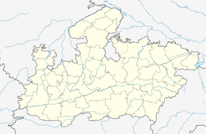
 Jaithari Location in Madhya Pradesh, India  Jaithari Jaithari (India) | |
| Coordinates: 23.043168°N 81.80377°E | |
| Country | |
| State | Madhya Pradesh |
| District | Anuppur |
| Area | |
| • Total | 5 km2 (2 sq mi) |
| Elevation | 490 m (1,610 ft) |
| Population (2001) | |
| • Total | 7,800 |
| Languages | |
| • Official | Hindi and English |
| Time zone | UTC+5:30 (IST) |
| PIN | 484330 |
| Telephone code | 07659 |
Geography
Jaithari is located at 23.043168°N 81.80377°E. second largest tahsil of Anuppur district total villages 108 village '
Demographics
As of the 2001 India census,[1] the total population of Jaithari was 8,9000, with 4,1480 male and 3,7520 female residents.
Railway station
Jaithari can be accessed by Jaithari Railway Station, which is part of the South East Central Railway zone.
Locations within tehsil
Guwari, Murra Tola, Dhangwan, Chandpur are four main villages of Jaithari tehsil. The Son Nadi river flows through the tehsil and it is well known for the Jaithari Thermal Power Project (Moserbaer power plant) which opened in 2014.[2]
The market of Jaithari town is famous for mangoes and tomatoes. Guwari is the main village of Jaithari town.
References
- "Census of India 2001: Data from the 2001 Census, including cities, villages and towns (Provisional)". Census Commission of India. Archived from the original on 16 June 2004. Retrieved 1 November 2008.
- "Moserbaer thermal power plant at Jaithari, Madhya Pradesh, India". Environmental Justice Atlas. Retrieved 30 October 2017.