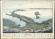
Italian geographical region
The Italian geographical region (or Italian physical region, Italian region) is a geographical region of Southern Europe delimited to the north and west by the chain of the Alps. This region is composed of a continental part in the north, a peninsular part and an insular part. Located between the Iberian Peninsula and the Balkan Peninsula, it overlooks the Mediterranean Sea and in particular the Ligurian Sea, the Tyrrhenian Sea, the Sea of Corsica, the Sea of Sardinia, the Sardinian Channel, the Sicilian Sea, the Strait of Sicily, the Ionian Sea and the Adriatic Sea.
The Italian geographic region[1][2] in its traditionally and most widely accepted conformation has an area of approximately 324,000 square kilometres (125,000 sq mi),[1] greater than that occupied by almost the entire Italian Republic with just over 301.340 square kilometres (116.348 sq mi), since in the region also includes territories which are part of France, Switzerland, Slovenia and Croatia and which also include four small independent states: the Republic of Malta, the Republic of San Marino, the Principality of Monaco and the Vatican City.[3]
Geography

Physical geography
In common language when we talk about the Italian region we generally talk about the Italian peninsula. Similarly, the inhabitants of the islands use the term continent to designate the mainland that goes from the Alps to Reggio Calabria. In reality, the Italian region includes a continental part, a peninsular part and an insular part.
Continental part
The continental part, delimited to the north by the Alpine watershed, corresponds to about 40% of the Italian region and is located in the north of an imaginary line that goes from the mouth of the Magra river to that of the Rubicone river. Most of them are made up of the water catchment areas of the Po, Adige, Brenta, Piave, Tagliamento and Isonzo rivers. From the continental part, however, some Alpine valleys are excluded which, although they are part of the Italian State, such as the Val di Lei tributary of the North Sea through the Rhine river, the Val di Livigno, the Sella di Dobbiaco and the Tarvisio basin to the north-east of the Camporosso saddle, tributaries of the Black Sea through rivers affluent of the Danube.
Peninsular part
The Italian peninsula, or the Italian peninsula, is a peninsula on the European continent crossed by the Apennine chain and delimited by four seas: the Ligurian Sea, the Tyrrhenian Sea, the Ionian Sea and the Adriatic Sea. It is one of the three peninsulas that make up Southern Europe with the Iberian peninsula and the Balkan peninsula.
Actually, the peninsula in the geographical sense begins from the Tuscan-Romagna Apennines, starting from an imaginary line that goes from the mouth of the Magra river to that of the Rubicone river, and extends to the extreme southern offshoot of Capo Spartivento in Calabria. The peninsula has an extension of about 1.000 kilometre (0.621 mi) in a north-west / south-east direction. The closest large islands, Sicily, Sardinia and Corsica, are not part of it. The peninsula corresponds to about 45% of the Italian geographical region.
Insular part
The island part extends over an area of about 60.000 square kilometres (23.166 sq mi) (about 18% of the whole Italian region), of which 58.000 square kilometres (22.394 sq mi) for Sicily, Sardinia and Corsica. Outside these large islands, numerous smaller islands, often grouped in archipelagos, are found along the Italian coast, mostly in the Tyrrhenian Sea. The list below shows the largest islands belonging to the Italian geographical region:
| Name | Area | Sea | Country |
|---|---|---|---|
| Sicily | 25,460 km2 (9,830 sq mi) | Mediterranean, Ionian | |
| Sardinia | 24,090 km2 (9,300 sq mi) | Mediterranean, Tyrrhenian | |
| Corsica[4][5] | 8,681 km2 (3,352 sq mi) | Mediterranean, Tyrrhenian | |
| Cherso/Cres | 406 km2 (157 sq mi) | Adriatic | |
| Malta | 246 km2 (95 sq mi) | Mediterranean | |
| Elba | 223 km2 (86 sq mi) | Tyrrhenian | |
| Sant'Antioco | 109 km2 (42 sq mi) | Mediterranean | |
| Pantelleria | 83 km2 (32 sq mi) | Mediterranean | |
| Lussino/Lošinj[notes 1] | 74 km2 (29 sq mi) | Adriatic | |
| Gozo | 64 km2 (25 sq mi) | Mediterranean | |
| San Pietro | 51 km2 (20 sq mi) | Mediterranean |
Notes
- L'appartenenza o meno delle isole di Cherso, Lussino e Veglia alla regione geografica italiana varia a seconda delle fonti. In particolare taluni vedono le prime due come continuazione naturale della penisola istriana, essendo tra l'altro Cherso e Lussino più vicine alla costa istriana che a quella dalmata, a differenza di Veglia. Inoltre varie isole minori mostrano una continuità tra Veglia e Arbe, isola nettamente dalmata.
References
- De Agostini Ed., L'Enciclopedia Geografica - Vol.I - Italia, 2004, p. 78
- Mauri, A., La presentazione di una storia delle frontiere orientali italiane: una occasione per riflettere sulle determinanti storiche, economiche e geopolitiche dei confini, Working Paper n. 2007-41, Università degli Studi di Milano, 2007
- "Archives historiques de la Suisse italienne" ("Archivio Storico della Svizzera Italiana"), Volumes 9-11, Université de Californie, 1934
- Italia nell'Enciclopedia Treccani
- Italia nell'enciclopedia "Sapere" - DeAgostini