Isfara District
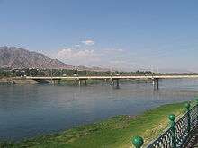
Isfara District or Nohiya-i Isfara (Tajik: Ноҳияи Исфара) is a district at the northeastern edge of Sughd province, Tajikistan, bordering on Uzbekistan's Ferghana Valley to the north and Kyrgyzstan to the south.[1] Its capital is Isfara. Vorukh, an enclave surrounded by Kyrgyzstan, is also part of Isfara.
Isfara District Ноҳияи Исфара | |
|---|---|
| Ноҳияи Исфара | |
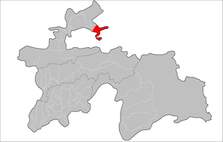 Location of Isfara District in Tajikistan | |
| Country | |
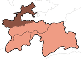
| Province | Sughd |
| Capital | Isfara |
| Time zone | UTC+5 (TJT) |
Administrative divisions
The district is divided administratively into jamoats. They are as follows (and population).[2]
| Jamoats of Isfara District | |||||||||||
| Jamoat | Population | ||||||||||
|---|---|---|---|---|---|---|---|---|---|---|---|
| Chilgazi | 12150 | ||||||||||
| Chorku | 28846 | ||||||||||
| Khonabad | 9614 | ||||||||||
| Kulkent | 17732 | ||||||||||
| Lakkon | 5514 | ||||||||||
| Navgilem | 28311 | ||||||||||
| Shahrak | 13991 | ||||||||||
| Surkh | 10396 | ||||||||||
| Vorukh | 23121 | ||||||||||
gollark: ?emojistats
gollark: ?emojistata
gollark: <@474286909636476939> I briefly got really confused and thought my eyes had broken.
gollark: <:chips:453465151132139521> <:chips:453465151132139521> <:chips:453465151132139521> <:chips:453465151132139521> <:chips:453465151132139521> <:chips:453465151132139521> <:chips:453465151132139521> <:chips:453465151132139521> <:chips:453465151132139521> <:chips:453465151132139521> <:chips:453465151132139521> <:chips:453465151132139521> <:chips:453465151132139521> <:chips:453465151132139521> <:chips:453465151132139521> <:chips:453465151132139521> <:chips:453465151132139521> <:chips:453465151132139521> <:chips:453465151132139521> <:chips:453465151132139521> <:chips:453465151132139521> <:chips:453465151132139521> <:chips:453465151132139521> <:chips:453465151132139521>
gollark: <:chips:453465151132139521> <:chips:453465151132139521> <:chips:453465151132139521> <:chips:453465151132139521> <:chips:453465151132139521> <:chips:453465151132139521> <:chips:453465151132139521> <:chips:453465151132139521> <:chips:453465151132139521> <:chips:453465151132139521> <:chips:453465151132139521> <:chips:453465151132139521> <:chips:453465151132139521> <:chips:453465151132139521> <:chips:453465151132139521> <:chips:453465151132139521> <:chips:453465151132139521> <:chips:453465151132139521> <:chips:453465151132139521> <:chips:453465151132139521> <:chips:453465151132139521> <:chips:453465151132139521> <:chips:453465151132139521> <:chips:453465151132139521>
References
- Republic of Tajikistan, map showing administrative division as of January 1, 2004, "Tojjikoinot" Cartographic Press, Dushanbe
- "List of Jamoats". UN Coordination, Tajikistan. Archived from the original on July 16, 2011. Retrieved April 4, 2009.
External links
- Habib Borjian, "Esfara", in Encyclopaedia Iranica, Columbia University (enter keyword "Esfara" in search field to access the article).
This article is issued from Wikipedia. The text is licensed under Creative Commons - Attribution - Sharealike. Additional terms may apply for the media files.