Interstate 215 (California)
Interstate 215 (I-215) is a 54.5-mile-long (87.7 km) north–south auxiliary Interstate Highway in the Inland Empire region of the Greater Los Angeles urban area in Southern California. It has portions designated as the Barstow, Escondido, and Armed Forces Freeways. I-215 is a bypass auxiliary route of I-15, running from Murrieta to northern San Bernardino. While I-215 connects the city centers of both Riverside and San Bernardino, its parent I-15 runs to the west through Corona and Ontario.
| ||||
|---|---|---|---|---|
%26groups%3D_685971e92acddb507c5624d91f577cfaa15da3fc.svg)
I-215 highlighted in red | ||||
| Route information | ||||
| Auxiliary route of I-15 | ||||
| Defined by Streets and Highways Code § 515 | ||||
| Maintained by Caltrans | ||||
| Length | 55.060 mi[1] (88.610 km) | |||
| Existed | 1982–present | |||
| History | 1960s as a highway, 1982 as a number | |||
| Major junctions | ||||
| South end | ||||
| North end | ||||
| Location | ||||
| Counties | Riverside, San Bernardino | |||
| Highway system | ||||
| ||||
.svg.png)
Part of I-215 was once signed as Interstate 15E (I-15E), but this was changed in 1974 as almost all of the Interstates around the country with directional suffixes were eventually renumbered or eliminated.
Route description
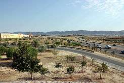
The southern terminus of I-215 is at the junction of I-15 in the city of Murrieta, in southwestern Riverside County. It then runs north through Menifee and Perris and along March Air Reserve Base before joining State Route 60 (SR 60) near Moreno Valley.
I-215 overlaps with SR 60 for about 5 miles (8.0 km) in Riverside and splits from it at SR 91, where it then travels through Colton, Grand Terrace and San Bernardino before rejoining I-15 near the small San Bernardino neighborhood of Devore.
This route is an alternative to I-15 for drivers traveling from Phoenix, Las Vegas, or San Bernardino, to the San Diego metropolitan area. This route offers more of a distance advantage since it is an alternative to I-15's alignment that is about 10 miles (16 km) to the west of, and roughly parallel to, I-215. The distance between the two I-15/I-215 junctions is almost 6 miles (9.7 km) shorter using I-215 rather than I-15.
However, the traffic and time "advantage" on I-215 is limited by three factors: the segment between the I-15/I-215 "Devore junction" and San Bernardino only has two lanes in each direction (on the other hand, I-15 has four), it is co-signed with SR 60 through Riverside, and that, while there are three lanes in each direction between Murrieta Hot Springs Road and SR 60, each city along this part of the corridor is undergoing rapid population growth, which has contributed to increased traffic congestion during and outside of peak hours.
I-215 is also used by local residents as the major north–south route for the urbanized portions of the San Bernardino–Riverside–Ontario metropolitan area. (I-15 serves a similar function in the western portion of the metropolitan area; the two are the only continuous north–south freeways in the area.)
I-215 is part of the California Freeway and Expressway System,[2] and is part of the National Highway System,[3] a network of highways that are considered essential to the country's economy, defense, and mobility by the Federal Highway Administration.[4] I-215 is eligible for the State Scenic Highway System,[5] but it is not officially designated as a scenic highway by the California Department of Transportation.[6] On January 24, 1957, the State Highway Commission defined the Escondido Freeway as what is now Routes 15 and 215 from Route 805 to Route 91. This entire segment was previously Route 395 when it was named. From the SR 60/SR 91 interchange in Riverside to I-10 near San Bernardino, the highway is known as the Riverside Freeway. Between Highland Avenue in San Bernardino and its northern terminus, I-215 is named the Barstow Freeway.[7] Unofficially, I-215 is known as the Armed Forces Freeway between SR 60 and I-15, given its proximity to the March Air Reserve Base.[8]
History
| |
|---|---|
| Location | Murrieta-San Bernardino |
| Existed | 1972–1974 |
| |
|---|---|
| Location | Murrieta-San Bernardino |
| Existed | 1974–1982 |
| |
|---|---|
| Location | Riverside-San Bernardino |
| Existed | 1982–1994 |
The highway (not an Interstate) that is currently I-215 first opened in 1963 as part of U.S. Route 395 (US 395). The "mileposts" in Riverside County reflect this since they do not start at zero at the I-15 interchange in Murrieta. Around 1968, U.S. 395 was renumbered as I-15 (the original proposed route, as SR 71's proposed number was I-15W/SR 31 Hamner-Milliken). This segment of US 395 was again renumbered in 1972 as (Temporary) I-15E. Next in 1974, this route was renumbered as State Route 194. In 1982, this route was then renumbered as I-215 north of SR 60, and as State Route 215 south of SR 60. Once SR 215 was upgraded to Interstate Highway standards, it became part of I-215 in 1994. Prior to its upgrade to Interstate standards, there were traffic signals at SR 74, as well as at Alessandro Boulevard (in Moreno Valley); two railroad crossings had also intersected the I-215 expressway at SR 74 and south of Cactus Avenue at then-March Air Force Base.
Due to the fact that the I-215 designation was overlaid upon existing freeways between the southern junction with SR 60 and the city of San Bernardino, the SR 60/SR 91/I-215 interchange in the city of Riverside has been widely known for its confusing nature concerning the numbering of I-215. While SR 60 continues east-and-west through this interchange, and SR 91 continues southwest (and formerly to the north), the I-215 designation continues away from this interchange on SR 60 east and the former northern portion of SR 91 (now solely numbered I-215). Travelers following I-215 in either direction need to "change freeways" at this interchange, instead of just following through lanes. The interchange was reconstructed to include some high-speed flyovers, one of which carries I-215 southbound traffic. In addition, when I-215 temporarily co-signs SR 60 in Riverside, the mileposts for I-215 supersede mileposts for SR 60. Motorists traveling east-west on SR 60 must begin counting exits at a new number, in the reverse order, during the I-215 overlap.
San Bernardino widening project
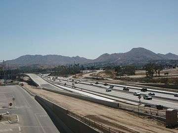
A joint project between Caltrans and SANBAG of San Bernardino County to widen I-215 between Orange Show Road and University Parkway in San Bernardino began in 2007.[9] With its completion, the project added one general use lane and one carpool lane in each direction, bringing the total number of lanes from six to 10 lanes across. The 7.5-mile, $723 million project included the reconstruction of all underpasses and overpasses within the project as well as connector ramps between I-215 and SR 210. This major expansion and revitalization project will help reduce congestion and improve traffic flow on this freeway that serves as a gateway to the Victor Valley, Riverside County, Orange County, Los Angeles County and points beyond. The widening was completed in late 2013, and all construction signage and equipment were completely removed by Spring of 2014.[10]
- Phase 1 status: Reconstruction of 5th Street Bridge. Work began in January 2007 and was completed in November 2008, approximately six months ahead of schedule and $2 million under budget.[11] The 5th Street bridge was built in phases with the new bridge being constructed alongside the old structure to allow for continuous use of the east/west corridor during construction.
- Phase 2 status: Freeway widening between Orange Show Road and Rialto Avenue. Construction began on Phase 2 in December 2007 and was completed in July 2010.[11] In addition to the reconstruction of various bridges, the freeway was widened from three to five lanes in each direction through this stretch of road. Aesthetic wallscapes depict the City’s iconic symbols including palm trees, the San Bernardino mountain range, fountains representing the local springs and more.
- Phase 3 status: Freeway widening between Rialto Avenue to Massachusetts Avenue. Construction began in September 2009 and finished in mid-2013. This phase received $128 million in American Recovery and Reinvestment Act of 2009 (ARRA) funds, one of the largest allocations of funding to a construction project in the country.[12] As part of this phase, the freeway was widened from three to five lanes in each direction along with the reconstruction of various bridges and underpasses. Following construction completion, all fast-lane entrances and exits were eliminated with drivers using new 5th Street and Baseline Street on-ramps that connect directly to the newly constructed bridges. This new configuration provides more balanced access to the west and east sides of the city. Also, residents living alongside the northbound side of the freeway have a soundwall to help block out freeway noise.
- Phase 4 status: freeway widening between Massachusetts Avenue and University Parkway. Construction began in January 2010 and was completed in November 2012.[13] A key feature in this phase was the construction of I-215/SR 210 connector ramps. Drivers now have direct access to these freeways in all directions. In addition to a general-purpose and carpool lane added in each direction south of the I-215/SR 210 interchange, a southbound auxiliary lane and a northbound general-purpose lane have been added between University Parkway and the I-215/SR 210 interchange.
Future
Many improvements are in the works along the entire length of the Interstate 215 corridor. Several interchanges are planned to be built or are currently being improved, such as the interchanges at Scott Road in Menifee[14] and Barton Road in Grand Terrace.[15] The interchange at University Parkway in San Bernardino is planned to be converted into a diverging diamond interchange.[16] Long-range plans include adding a carpool lane in each direction on a 10.75-mile section of I-215 between Nuevo Road in Perris and SR 60 near Moreno Valley.[17] There are also plans to connect I-215 at its southern terminus to a planned collector-distributor system on I-15 near the Temecula-Murrieta border, providing access to interchanges at French Valley Parkway and Winchester Road.[18]
Exit list
Except where prefixed with a letter, postmiles were measured on the road as it was in 1964, based on the alignment of US 395 as it existed at that time, and do not necessarily reflect current mileage. R reflects a realignment in the route since then, M indicates a second realignment, L refers an overlap due to a correction or change, and T indicates postmiles classified as temporary (for a full list of prefixes, see the list of postmile definitions).[1] Segments that remain unconstructed or have been relinquished to local control may be omitted. The numbers reset at county lines; the start and end postmiles in each county are given in the county column.
| County | Location | Postmile [1][19][20] | Exit [21] | Destinations | Notes |
|---|---|---|---|---|---|
| Riverside RIV R9.00–45.33 | Murrieta | R9.00 | Southbound exit and northbound entrance; southern terminus; I-15 exit 63 northbound | ||
| R9.51 | 1 | ||||
| R10.65 | 2 | Los Alamos Road | |||
| R12.51 | 4 | Clinton Keith Road | |||
| Murrieta–Menifee line | R14.50 | 6 | Keller Road | Proposed interchange[22] | |
| R15.52 | 7 | Scott Road | |||
| Menifee | R18.52 | 10 | Newport Road | ||
| R20.84 | 12 | McCall Boulevard — Sun City | |||
| Perris | 22.76 | 14 | Ethanac Road | ||
| 23.54 | 15 | South end of SR 74 overlap | |||
| 26.31 | 17 | North end of SR 74 overlap | |||
| 27.23 | 18 | D Street | Southbound exit and northbound entrance | ||
| R27.89 | 19 | Nuevo Road | |||
| R29.50 | 21 | Placentia Avenue | Construction to begin in fall 2020[23] | ||
| R30.93 | 22 | Ramona Expressway, Cajalco Expressway — Lakeview, San Jacinto | |||
| R32.33 | 23 | Harley Knox Boulevard | Formerly Oleander Avenue[24] | ||
| March Air Reserve Base | R34.17 | 25 | Van Buren Boulevard — Riverside National Cemetery, March Field Air Museum | ||
| R35.76 | 27A | Cactus Avenue, Meridian Parkway — March JARB, Moreno Valley, Arnold Heights | Signed as exits 27A (Cactus Avenue east) and 27B (Cactus Avenue west/Meridian Parkway) southbound | ||
| Riverside–Moreno Valley line | R36.42 | 27B | Alessandro Boulevard | Signed as exit 27C southbound | |
| R37.44 | 28 | Eucalyptus Avenue, Eastridge Avenue | |||
| Riverside | R38.34 | 29 | South end of SR 60 overlap; SR 60 exit 58 westbound | ||
| R38.92 | 30A | Box Springs Road, Fair Isle Drive — Box Springs | Northbound exit is via SR 60 west | ||
| 39.48 | 30B | Central Avenue, Watkins Drive | |||
| 40.28 | 31 | El Cerrito Drive | Closed | ||
| 40.98 | 32A | Martin Luther King Boulevard | Signed as exit 31 northbound | ||
| 41.49 | 32B | University Avenue | Signed as exit 32 northbound | ||
| 42.16 | 33 | Blaine Street, 3rd Street | |||
| 42.84 | 34A | Spruce Street | Closed | ||
| 43.27 | 34B | Left exit southbound; SR 91 exits 65B-C; former US 91 south | |||
| 43.27 | 34C | North end of SR 60 overlap; left exit northbound; SR 60 exit 53B eastbound | |||
| 43.90 | 35 | Columbia Avenue | |||
| 45.01 | 36 | Center Street — Highgrove | |||
| San Bernardino SBD 0.00–17.75 | Colton | 0.40 | 37 | La Cadena Drive, Iowa Avenue — Colton | |
| Grand Terrace | 1.31 | 38 | Barton Road | ||
| Colton | 2.69 | 39 | Mt. Vernon Avenue, Washington Street | Mount Vernon Avenue was old US 66/US 91/US 395 | |
| 4.05 | 40 | Signed as exits 40A (east) and 40B (west) northbound; former US 70/US 99; I-10 exit 72 | |||
| San Bernardino | 5.03 | 41 | Orange Show Road, Auto Plaza Drive | ||
| 5.58 | 42A | Inland Center Drive — Inland Center Mall | |||
| 6.06 | 42B | Mill Street — San Bernardino Airport | |||
| 6.79 | 43 | 2nd Street, 3rd Street — San Bernardino Civic Center | |||
| 7.18 | 44A | Signed as exit 44 southbound | |||
| 8.08 | 44B | Base Line Street | Signed as exit 45 southbound | ||
| 8.60 | 45A | Northbound exit and southbound entrance; SR 210 exit 75B westbound | |||
| 9.03 | 45B | Muscupiabe Drive | Closed | ||
| 9.36 | 46A | Highland Avenue | Southbound exit is via exit 46B | ||
| 9.72 | 46B | Mt. Vernon Avenue, 27th Street | |||
| 10.05 | 46C | Future I-210; SR 210 exit 74; former SR 30 | |||
| 11.63 | 48 | University Parkway — Cal State San Bernardino, University District | Former SR 206 north | ||
| 14.09 | 50 | Palm Avenue, Kendall Drive — Verdemont | Former SR 206 south | ||
| 17.32 | 54A | Devore Road — Devore | Signed as exit 54 southbound; former US 66 west | ||
| 17.75 | 54B | Northbound exit and southbound entrance; I-15 exit 123 | |||
| 17.75 | Northbound exit and southbound entrance; northern terminus | ||||
1.000 mi = 1.609 km; 1.000 km = 0.621 mi
| |||||
See also

References
- California Department of Transportation. "State Truck Route List". Sacramento: California Department of Transportation. Archived from the original (XLS file) on June 30, 2015. Retrieved June 30, 2015.
- "Article 2 of Chapter 2 of Division 1 of the California Streets and Highways Code". Sacramento: California Office of Legislative Counsel. Retrieved February 6, 2019.
- Federal Highway Administration (March 25, 2015). National Highway System: Riverside–San Bernardino, CA (PDF) (Map). Scale not given. Washington, DC: Federal Highway Administration. Retrieved September 10, 2017.
Federal Highway Administration (March 25, 2015). National Highway System: Temecula, CA (PDF) (Map). Scale not given. Washington, DC: Federal Highway Administration. Retrieved September 10, 2017. - Natzke, Stefan; Neathery, Mike & Adderly, Kevin (June 20, 2012). "What is the National Highway System?". National Highway System. Washington, DC: Federal Highway Administration. Retrieved July 1, 2012.
- "Article 2.5 of Chapter 2 of Division 1 of the California Streets & Highways Code". Sacramento: California Office of Legislative Counsel. Retrieved February 6, 2019.
- California Department of Transportation (August 2019). "Officially Designated State Scenic Highways and Historic Parkways" (XLSX). Sacramento: California Department of Transportation. Retrieved September 10, 2017.
- California Department of Transportation; California State Transportation Agency (January 2015). 2014 Named Freeways, Highways, Structures and Other Appurtenances in California. Sacramento: California Department of Transportation. pp. 94, 98, 101, 116, 227. Archived from the original (PDF) on May 30, 2015. Retrieved May 30, 2015.
- Google Maps
- "I-215 Widening Project". Retrieved October 5, 2014.
- SANBAG: Measure I Freeway Projects Archived July 15, 2007, at the Wayback Machine
- SANBAG. "SANBAG: Phase I". Archived from the original on May 8, 2012. Retrieved November 2012. Check date values in:
|accessdate=(help) - SANBAG. "SANBAG: ARRA". Retrieved November 2012. Check date values in:
|accessdate=(help) - SANBAG. "SANBAG: Phase VI". Archived from the original on May 8, 2012. Retrieved November 2012. Check date values in:
|accessdate=(help) - "Scott Road/I-215 Interchange Project | Menifee, CA - Official Website". www.cityofmenifee.us. Retrieved April 9, 2019.
- "SBCTA: nterstate 215: Barton Road Interchange, Grand Terrace". SBCTA. Retrieved April 8, 2019.
- "I-215 @ University Parkway". Diverging Diamond Interchange. Retrieved April 8, 2019.
- "I-215 North Project". Riverside County Transportation Commission. Retrieved April 8, 2019.
- "French Valley Parkway Interchange | Temecula CA". temeculaca.gov. Retrieved April 8, 2019.
- California Department of Transportation (July 2007). "Log of Bridges on State Highways". Sacramento: California Department of Transportation.
- California Department of Transportation, All Traffic Volumes on CSHS, 2005 and 2006
- California Department of Transportation, California Numbered Exit Uniform System, I-215 Northbound and I-215 Southbound, accessed February 2008
- "Capital Improvement Projects". City of Murrieta. Retrieved November 25, 2018.
- "Mid-County Parkway Project in Western Riverside County". Riverside County Transportation Commission. Retrieved July 12, 2020.
- "Harley Knox Boulevard". Cityofperris.org. Retrieved January 26, 2013.
External links
| Wikimedia Commons has media related to Interstate 215. |