Ifelodun, Kwara
Ifelodun is a local government area in Kwara State, Nigeria. Its headquarters is in the town of Share.[1]
Ifelodun | |
|---|---|
| Ifelodun local government area | |
| Country | |
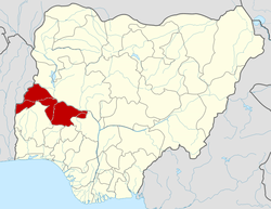
| State | Kwara State |
| Seat | Share |
| Time zone | UTC+1 (WATGMT) |
| Area code(s) | 004 |
| Website | www.ifelodunkwara.org.ng |
The people of Ifelodun are Yorubas and mostly of Igbomina origin with roots in Ife, Oyo and Ketu. Much of the Ifelodun domain was overtaken by the Afonja/Alimi era and annexed to the present Ilorin enclave.
It has an area of 3,435 km² and a population of 206,042 at the 2006 census.
The postal code of the area is 241.[2] It includes at least 80 villages and towns.
Religion
There are three main religious groups,
- Christianity
- Islam
- Others (Ifa, Sango, Elegun/Mascurade, Opele, etc.)
gollark: The owners of``` code | type | clicks | uniqueViews | views | hoursRemaining | sick | createdAt | updatedAt -------+-----------+--------+-------------+-------+----------------+------+----------------------------+---------------------------- XAn** | hatchling | 8 | 842 | 9208 | 155 | t | 2018-09-04 17:51:17.146+00 | 2018-09-05 12:27:43.868+00 5eA** | hatchling | 17 | 571 | 6372 | 159 | t | 2018-09-05 02:07:02.204+00 | 2018-09-05 12:27:44.481+00 aLv** | hatchling | 1 | 1347 | 14052 | 109 | t | 2018-09-04 20:24:56.434+00 | 2018-09-05 12:27:44.483+00 wOv** | hatchling | 2 | 597 | 7407 | 153 | t | 2018-09-04 20:33:48.953+00 | 2018-09-05 12:27:44.483+00 dDW** | hatchling | 3 | 819 | 9280 | 157 | t | 2018-09-04 20:14:24.368+00 | 2018-09-05 12:27:44.482+00```should probably fog their stuff - they're autoexcluded from my hatchery, but not others.
gollark: That could be a cool hatchery/fansite feature.
gollark: Okay, so apparently that dropped it down to 87 dragons.
gollark: I've decided to just check whether the score is significantly (maybe 1.5x) bigger than the optimal score for their time.
gollark: .
References
- "Ifelodun Local Government Area". Kwara State Government. Archived from the original on 6 May 2014. Retrieved 8 September 2014.
- "Post Offices- with map of LGA". NIPOST. Archived from the original on 2009-10-07. Retrieved 2009-10-20.
State capital: Ilorin | ||
| Governors |
|  |
| LGAs | ||
| Cities | ||
| Towns |
| |
This article is issued from Wikipedia. The text is licensed under Creative Commons - Attribution - Sharealike. Additional terms may apply for the media files.