Ibrahimpatnam, Krishna district
Ibrahimpatnam is a neighbourhood of Vijayawada in Krishna district of the Indian state of Andhra Pradesh. It is also the mandal headquarters of Ibrahimpatnam mandal.[4][1] Dr Narla Tata Rao Thermal Power Station, one of the major Thermal power stations of the state is located near the town.[5] Railway Wagon Workshop at Rayanapadu is also located very near to Ibrahimpatnam at a distance of 4 km.
Ibrahimpatnam | |
|---|---|
.svg.png) Ibrahimpatnam | |
| Coordinates: 16°36′20″N 80°22′3″E | |
| Country | India |
| State | Andhra Pradesh |
| District | Krishna |
| Mandal | Ibrahimpatnam |
| Area | |
| • Total | 15.00 km2 (5.79 sq mi) |
| Elevation | 27 m (89 ft) |
| Population (2011)[3] | |
| • Total | 29,432 |
| Time zone | UTC+5:30 (IST) |
| PIN | 521456 |
| Telephone code | +91–866 |
Demographics
As of 2011 census, the village had a population of 29,432. The total population constitute, 13,690 males and 15,742 females —a sex ratio of 1,150 females per 1000 males. 3,052 children are in the age group of 0–6 years, of which 1,514 are boys and 1,538 are girls —a ratio of 1,016 per 1000. The average literacy rate stands at 78.37% with 20,673 literates, significantly higher than the state average of 67.41%.[3][6]
Transport

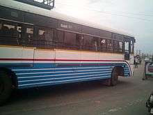
Kondapalli railway station is the nearest station to the town, located at a distance of 6 km on Kazipet–Vijayawada section. It is under the administeration of Vijayawada railway division of South Central Railway zone.[7] NH 65 passes through the town, which connects Vijayawada and Hyderabad. APSRTC operates city buses from Vijayawada to Ibrahimpatnam.
Education
The primary and secondary school education is imparted by government, aided and private schools, under the School Education Department of the state.[8][9] The medium of instruction followed by different schools are English, Telugu.
References
- "District Census Handbook - Krishna" (PDF). Census of India. pp. 16–17, 48. Retrieved 18 January 2015.
- "Elevation". Veloroutes. Retrieved 16 September 2014.
- "Census 2011". The Registrar General & Census Commissioner, India. Retrieved 15 September 2014.
- "Krishna District Mandals" (PDF). Census of India. pp. 492, 526. Retrieved 21 January 2015.
- "Dr. Narla Tata Rao Thermal Power Station". Andhra Pradesh Generation Corporation Limited. Retrieved 14 January 2015.
- "Literacy of AP (Census 2011)" (PDF). Official Portal of Andhra Pradesh Government. p. 43. Archived from the original (PDF) on 14 July 2014. Retrieved 16 September 2014.
- "Overview of Kondapalli Station". indiarailinfo. Retrieved 13 January 2015.
- "School Education Department" (PDF). School Education Department, Government of Andhra Pradesh. Archived from the original (PDF) on 27 December 2015. Retrieved 7 November 2016.
- "The Department of School Education - Official AP State Government Portal | AP State Portal". www.ap.gov.in. Archived from the original on 7 November 2016. Retrieved 7 November 2016.