Hutsonville Township, Crawford County, Illinois
Hutsonville Township is one of ten townships in Crawford County, Illinois, USA. As of the 2010 census, its population was 1,177 and it contained 550 housing units.[2]
Hutsonville Township | |
|---|---|
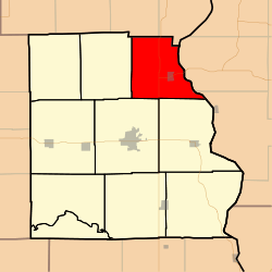 Location in Crawford County | |
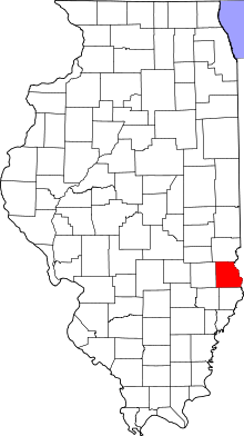 Crawford County's location in Illinois | |
| Coordinates: 39°07′04″N 87°41′03″W | |
| Country | United States |
| State | Illinois |
| County | Crawford |
| Established | November 5, 1867 |
| Area | |
| • Total | 37.51 sq mi (97.2 km2) |
| • Land | 36.81 sq mi (95.3 km2) |
| • Water | 0.69 sq mi (1.8 km2) 1.84% |
| Elevation | 486 ft (148 m) |
| Population (2010) | |
| • Estimate (2016)[1] | 1,142 |
| • Density | 32/sq mi (12/km2) |
| Time zone | UTC-6 (CST) |
| • Summer (DST) | UTC-5 (CDT) |
| ZIP codes | 62433, 62451, 62454, 62478 |
| FIPS code | 17-033-36854 |
Geography
According to the 2010 census, the township has a total area of 37.51 square miles (97.2 km2), of which 36.81 square miles (95.3 km2) (or 98.13%) is land and 0.69 square miles (1.8 km2) (or 1.84%) is water.[2] The Wabash River defines its eastern border.
Cities, towns, villages
Unincorporated towns
Cemeteries
The township contains these eight cemeteries: Ball, Bradbury, Draper, Guyer, Hutson Old, Hutsonville New, Lindley and Musgrave.
Major highways
School districts
- Hutsonville Community Unit School District 1
- Palestine Community Unit School District 3
- Robinson Community Unit School District 2
Political districts
- Illinois' 15th congressional district
- State House District 109
- State Senate District 55
gollark: You may need to reload occasionally while I update the code.
gollark: Yes.
gollark: Okay, reload NOW.
gollark: Reload now?
gollark: Great, and everyone will lose their progress when I restart it.
References
- "Hutsonville Township, Crawford County, Illinois". Geographic Names Information System. United States Geological Survey. Retrieved 2010-01-10.
- United States Census Bureau 2007 TIGER/Line Shapefiles
- United States National Atlas
- "Population and Housing Unit Estimates". Retrieved June 9, 2017.
- "Population, Housing Units, Area, and Density: 2010 - County -- County Subdivision and Place -- 2010 Census Summary File 1". United States Census. Archived from the original on 2020-02-12. Retrieved 2013-05-28.
- "Census of Population and Housing". Census.gov. Retrieved June 4, 2016.
External links
Places adjacent to Hutsonville Township, Crawford County, Illinois | |
|---|---|
Municipalities and communities of Crawford County, Illinois, United States | ||
|---|---|---|
| City | Map of Illinois highlighting Crawford County | |
| Villages | ||
| Townships | ||
| CDPs | ||
| Other unincorporated communities | ||
| Ghost town | ||
| Footnotes | ‡This populated place also has portions in an adjacent county or counties | |
This article is issued from Wikipedia. The text is licensed under Creative Commons - Attribution - Sharealike. Additional terms may apply for the media files.