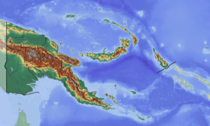
Hulia Rural LLG
Hulia Rural LLG a local-level government (LLG) of Koroba-Kopiago District in Hela Province, Papua New Guinea.[1][2]
Hulia Rural LLG | |
|---|---|
 Hulia Rural LLG Location within Papua New Guinea | |
| Coordinates: 5.945757°S 143.006102°E | |
| Country | Papua New Guinea |
| Province | Hela Province |
| Time zone | UTC+10 (AEST) |
Wards
- 01. Alua/Kambi
- 02. Kela
- 03. Uruma
- 04. Piangwanda
- 05. Puju
- 06. Tigibi 1
- 07. Wabia 2
- 08. Wabia 1
- 09. Iangome
- 10. Damita 1
- 11. Hol'la
- 12. Dimu
- 13. Homa Pawa
- 14. Honaga
- 15. Lau'u
- 16. Pagale
- 17. Yabagaru
- 18. Davi Davi
- 19. Kuyali
- 20. Yarale
- 21. Hogombe
- 22. Tigibi 3
- 23. Dauli 1
- 24. Damita 2
- 25. Dauli 2
- 26. Dauli 3
- 27. Peri
- 28. Wabia 2
- 29. Wabia 3
- 30. Hubi Yabe
- 31. Takipupi
gollark: I'll stop pinging you if you join T&S.
gollark: <@!399479031331946496> https://discord.gg/23DsfW
gollark: You can have this one instead:https://discord.gg/23DsfW
gollark: He had decided that ridiculous meta-writing with no sense of fourth wall were the best way to get <@!399479031331946496> to listen; it appeared to have worked, though with unintended consequences.
gollark: Oliver pasted https://discord.gg/dYgc3n in a Discord channel. This was a link for a better Discord server than the one he was currently in, though <@!399479031331946496> did not know it yet.
References
- "Census Figures by Wards - Highlands Region". www.nso.gov.pg. 2011 National Population and Housing Census: Ward Population Profile. Port Moresby: National Statistical Office, Papua New Guinea. 2014.
- "Final Figures". www.nso.gov.pg. 2011 National Population and Housing Census: Ward Population Profile. Port Moresby: National Statistical Office, Papua New Guinea. 2014.
- OCHA FISS (2018). "Papua New Guinea administrative level 0, 1, 2, and 3 population statistics and gazetteer". Humanitarian Data Exchange. 1.31.9.
- United Nations in Papua New Guinea (2018). "Papua New Guinea Village Coordinates Lookup". Humanitarian Data Exchange. 1.31.9.
This article is issued from Wikipedia. The text is licensed under Creative Commons - Attribution - Sharealike. Additional terms may apply for the media files.