Huancavelica District
Huancavelica District is one of nineteen districts of the province Huancavelica in Peru.[1]
Huancavelica Wankawillka | |
|---|---|
 Huancavelica | |
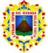
 Flag  Coat of arms | |
| Country | |
| Region | Huancavelica |
| Province | Huancavelica |
| Capital | Huancavelica |
| Government | |
| • Mayor | Rómulo Cayllahua Paytán (2019-2022) |
| Area | |
| • Total | 514.1 km2 (198.5 sq mi) |
| Elevation | 3,660 m (12,010 ft) |
| Population (2017) | |
| • Total | 39,776 |
| • Density | 77/km2 (200/sq mi) |
| Time zone | UTC-5 (PET) |
| UBIGEO | 090101 |
Geography
The Chunta mountain range traverses the district. Some of the highest mountains of the district are listed below:[2]
- Hatun Pirwayuq
- Hatun Q'asa
- Huch'uy Pirwayuq
- Kachi Mach'ay Urqu
- Kuntur Wamani
- Pinqullu
- Puka Q'asa
- Puka Urqu
- Puywan
- Qarwa K'anti
- Qarwa Urqu
- Qarwarasu
- Qucha Q'asa
- Tiklla Q'asa
- Ukhu P'ukru
- Wachu Intiyuq
- Wamanrasu
- Waqutuyuq
- Wayq'u Kancha
- Yana Kancha
gollark: I forgot how though.
gollark: Anyway, ABR has a connection open so I could instruct it to do things using the debug interface.
gollark: It's already too late.
gollark: You do realise that if I intended to "bee" you via that I could make ABR do it?
gollark: Oh, is it because I powered my laptop back on and it connected to IRC?
References
- (in Spanish) Instituto Nacional de Estadística e Informática. Banco de Información Distrital Archived 2008-04-23 at the Wayback Machine. Retrieved April 11, 2008.
- escale.minedu.gob.pe/ UGEL map Huancavelica Province 1 (Huancavelica Region)
This article is issued from Wikipedia. The text is licensed under Creative Commons - Attribution - Sharealike. Additional terms may apply for the media files.