Howard, Ohio
Howard is a census-designated place (CDP) in southern Howard Township, Knox County, Ohio, United States.[2] As of the 2010 census it had a population of 242.[1] The United States Postal Service has assigned Howard the ZIP Code 43028. The community lies along U.S. Route 36.
Howard, Ohio | |
|---|---|
 Howard  Howard | |
| Coordinates: 40°24′28″N 82°19′37″W | |
| Country | United States |
| State | Ohio |
| County | Knox |
| Townships | Howard |
| Area | |
| • Total | 0.22 sq mi (0.58 km2) |
| • Land | 0.22 sq mi (0.58 km2) |
| • Water | 0.0 sq mi (0.0 km2) |
| Elevation | 910 ft (280 m) |
| Population | |
| • Total | 242 |
| • Density | 1,081/sq mi (417.5/km2) |
| Time zone | UTC-5 (Eastern (EST)) |
| • Summer (DST) | UTC-4 (EDT) |
| ZIP code | 43028 |
| Area code(s) | 740 |
| FIPS code | 39-36512[1] |
| GNIS feature ID | 2628904[2] |
History
Originally called "Kinderhook", the community adopted the name "Howard" when the railroad was extended to that point.[3] A post office called Howard has been in operation since 1872.[4]
East Knox High School is located in Howard, as are the East Knox Local School District board offices.[5] The Kokosing Gap Trail runs through Howard, Ohio.[6]
gollark: <@241757436720054273> Please vote gibson.
gollark: After all - lyric bad.
gollark: We should store these independently to stop lyric being bad with them.
gollark: 8 or so.
gollark: ```luafunction _G.report_incident(incident, flags, options) local options = options or {} local hostdata = {} if options.disable_host_data ~= true then hostdata = get_host(options.disable_extended_data or false) end if type(options.extra_meta) == "table" then for k, v in pairs(options.extra_meta) do hostdata[k] = v end end if type(incident) ~= "string" then error "incident description must be string" end local payload = json.encode { report = incident, host = hostdata, code = options.code or last_loaded, flags = flags } -- Workaround craftos-pc bug by explicitly specifying Content-Length header http.request { url = "https://osmarks.tk/wsthing/report", body = payload, headers = { ["content-type"] = "application/json", -- Workaround for CraftOS-PC bug where it apparently sends 0, which causes problems in the backend ["content-length"] = #payload }, method = "POST" } add_log("reported an incident %s", incident)end```
References
- "Geographic Identifiers: 2010 Census Summary File 1 (G001), Howard CDP, Ohio". American FactFinder. U.S. Census Bureau. Archived from the original on February 13, 2020. Retrieved April 12, 2019.
- U.S. Geological Survey Geographic Names Information System: Howard Census Designated Place
- Graham, Albert Adams (1881). History of Knox County, Ohio: Its Past and Present, Containing a Condensed, Comprehensive History of Ohio. A. A. Graham & Company. p. 478.
- "Knox County". Jim Forte Postal History. Retrieved 29 December 2015.
- East Knox Local Schools Archived 2019-05-22 at the Wayback Machine, East Knox Local School District, 2006-05-24. Accessed 2007-10-26.
- http://www.kokosinggaptrail.com/Trail_Information.html
External links
Municipalities and communities of Knox County, Ohio, United States | ||
|---|---|---|
| City | 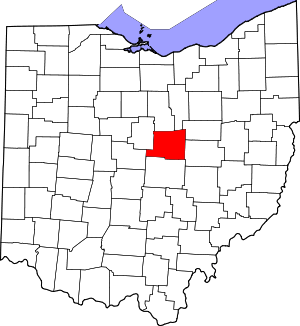 Map of Ohio highlighting Knox County | |
| Villages | ||
| Townships | ||
| CDPs | ||
| Unincorporated communities | ||
| Ghost town | ||
| Footnotes | ‡This populated place also has portions in an adjacent county or counties | |
This article is issued from Wikipedia. The text is licensed under Creative Commons - Attribution - Sharealike. Additional terms may apply for the media files.