Horní Bojanovice
Horní Bojanovice is a village and municipality (obec) in Břeclav District in the South Moravian Region of the Czech Republic.
Horní Bojanovice | |
|---|---|
Municipality | |
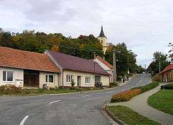 Northern part of the village | |
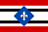 Flag  Coat of arms | |
 Horní Bojanovice | |
| Coordinates: 48°56′51″N 16°47′50″E | |
| Country | |
| Region | South Moravian |
| District | Břeclav |
| Area | |
| • Total | 8.37 km2 (3.23 sq mi) |
| Elevation | 228 m (748 ft) |
| Population (2006) | |
| • Total | 609 |
| • Density | 73/km2 (190/sq mi) |
| Postal code | 693 01 |
| Website | http://www.hornibojanovice.cz |
The municipality covers an area of 8.37 square kilometres (3.23 sq mi), and has a population of 609 (as at 3 July 2006).
Horní Bojanovice lies approximately 22 kilometres (14 mi) north of Břeclav, 31 km (19 mi) south-east of Brno, and 214 km (133 mi) south-east of Prague.
This article is issued from Wikipedia. The text is licensed under Creative Commons - Attribution - Sharealike. Additional terms may apply for the media files.