Honey Branch
Honey Branch is a tributary of the Stony Brook in Mercer County, New Jersey in the United States.
| Honey Branch | |
|---|---|
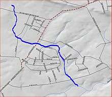 Map of Honey Branch | |
| Location | |
| Country | United States |
| Physical characteristics | |
| Source | |
| • coordinates | 40°22′15″N 74°46′6″W |
| Mouth | |
• coordinates | 40°20′17″N 74°44′29″W |
• elevation | 112 ft (34 m) |
| Basin features | |
| Progression | Stony Brook (Millstone River), Millstone River, Raritan River, Atlantic Ocean |
| River system | Raritan River system |
Course
The Honey Branch starts at 40°22′15″N 74°46′6″W.[1] It flows southeast, crossing Moores Mill Mt. Rose Road. It then turns east and flows across Pennington-Rocky Hill Road. It picks up several tributaries and drains into the Stony Brook Fourteen Basin. After the basin, it crosses Elm Ridge Road and drains into the Stony Brook at 40°20′17″N 74°44′29″W,[1] near Rosedale Park.
Sister tributaries
gollark: Yes, I can really see the value of mining in your own browser with some indirection.
gollark: Mine mostly just doesn't explicitly set background colors, so you can darktheme it if desired.
gollark: My website has a themes panel, which is obviously* better**.
gollark: Background images I guess.
gollark: That can't change image sources, actually.
See also
References
- "GNIS Detail - Honey Branch". USGS. Retrieved 22 July 2010.
External links
This article is issued from Wikipedia. The text is licensed under Creative Commons - Attribution - Sharealike. Additional terms may apply for the media files.