Hochatown, Oklahoma
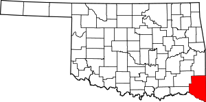
Hochatown is a community in McCurtain County, Oklahoma, United States, the second to hold the name after the first was flooded by the damming of the Mountain Fork River to create Broken Bow Lake.[2] The city lies within the Little Dixie region of Oklahoma, an area originally settled largely by Southerners seeking a new start following the American Civil War.
Hochatown, Oklahoma | |
|---|---|
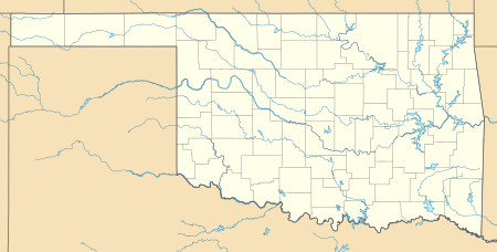
 Hochatown, Oklahoma Location within the state of Oklahoma  Hochatown, Oklahoma Hochatown, Oklahoma (the United States) | |
| Coordinates: 34°09′08″N 94°45′10″W[1] | |
| Country | United States |
| State | Oklahoma |
| County | McCurtain |
| Elevation | 715 ft (218 m) |
| Time zone | UTC-6 (Central (CST)) |
| • Summer (DST) | UTC-5 (CDT) |
| ZIP code | 74728 |
| Area code(s) | 580 |
History
First Hochatown
The land that would become Hochatown was owned by the Choctaw tribe, with twelve families moving into the area in the 1880s. Like Broken Bow, Hochatown grew around the Choctaw Lumber and Coal Company,(later named Dierks) gaining a post office in 1894 and become a bustling town by 1900.[2] The lumber company built a railroad spur between Hochatown and the community of Eagletown, Oklahoma to facilitate export of logs.[3]
At the time of its founding, Hochatown was located in Bok Tuklo County of the Apukshunnubbee District, one of three administrative super-regions comprising the Choctaw Nation.
During the 1920s and 1930s, prime lumber supply dwindled and the lumber company moved to other local areas. Meanwhile, the community became noted for its moonshine production. The town's heyday soon passed, however. The post office shut down in 1963 and the last family left the site in 1966. The cemetery and town church were moved to higher ground while all other buildings were destroyed. The area is now covered by 40 feet of water.[2]
Second Hochatown
The second incarnation of Hochatown is located approximately one mile west of Broken Bow Lake on U.S. Route 259.[4] Its economy is based on tourism. In addition to Broken Bow Lake, the area includes Beavers Bend Resort Park, Hochatown State Park, and Cedar Creek Golf Course at Beavers Bend.[2] Hunters also visit the region, which bills itself as the "deer capital of the world."[5]
References
- U.S. Geological Survey Geographic Names Information System: Hochatown, Oklahoma
- Morris, John Wesley (1978). Ghost Towns of Oklahoma. University of Oklahoma Press. ISBN 978-0806114200.
- Kelly, Mitch. "Hochatown." Undated. Accessed January 26, 2018.
- Stephens Gap, OK, 7.5 Minute Topographic Quadrangle, USGS, 1981
- Kiamichi Country (accessed April 6, 2010)
