Hindu Raj
The Hindu Raj (Urdu: سلسلہ کوہ ہندو راج) is a mountain range in northern Pakistan, between the Hindu Kush and the Karakoram ranges. Its highest peak is Koyo Zom, 6,872 m (22,546 ft). Other notable peaks include Buni Zom,[1] Ghamubar Zom and Gul Lasht Zom. The range is less well-known than its neighbors, partly because of the absence of any 8000 or 7000 meter peaks.
| Hinduraj | |
|---|---|
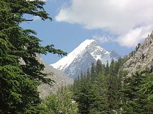 Falak Sher | |
| Highest point | |
| Peak | Koyo Zom |
| Elevation | 6,872 m (22,546 ft) |
| Naming | |
| Native name | سلسلہ کوہ ہندو راج |
| Geography | |
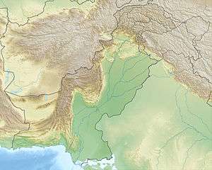 | |
| State | Khyber Pakhtunkhwa, Gilgit-Baltistan (Pakistan) |
| Range coordinates | 36°19′42″N 72°59′55″E |
Notes
- Sources disagree on whether Buni Zom is in the Hindu Raj or the Hindu Kush.
gollark: Location lookup forms can be requested via form request form (versions 3 to 11d only) or an expedited location form.
gollark: Or probably just [COMPANY EXPUNGED] Maps.
gollark: You'll need a location lookup form.
gollark: Primary Form Archive 22. It's open Fridays.
gollark: You'll need a form request form, or H-732-π.
This article is issued from Wikipedia. The text is licensed under Creative Commons - Attribution - Sharealike. Additional terms may apply for the media files.