Hilter
Hilter is a municipality in the district Osnabrück, Lower Saxony, Germany. It is located in the hills of the Teutoburg Forest.
Hilter | |
|---|---|
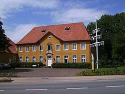 Town hall | |
 Coat of arms | |
Location of Hilter within Osnabrück district 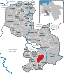  | |
 Hilter 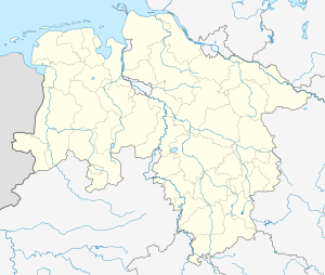 Hilter | |
| Coordinates: 52°9′N 8°9′E | |
| Country | Germany |
| State | Lower Saxony |
| District | Osnabrück |
| Subdivisions | 8 |
| Government | |
| • Mayor | Marc Schewski (CDU) |
| Area | |
| • Total | 52.6 km2 (20.3 sq mi) |
| Elevation | 198 m (650 ft) |
| Population (2018-12-31)[1] | |
| • Total | 10,361 |
| • Density | 200/km2 (510/sq mi) |
| Time zone | CET/CEST (UTC+1/+2) |
| Postal codes | 49176 |
| Dialling codes | 05424, 05409 |
| Vehicle registration | OS |
| Website | www.hilter.de |
As of 2002 it has a population of 10,178, and covers an area of 52.61 km². Highest elevation is the Hohnangel with 262 m above sea level.
History
The municipality was united on July 14, 1972, by merging the municipalities Borgloh, Hankenberge and Hilter. Already in 1977 the municipalities Allendorf, Borgloh-Wellendorf, Ebbendorf, Eppendorf and Uphöfen were joined into the Einheitsgemeinde Borgloh.
Industry
Hilter was well known for mining Hilter Gold ochre as well as its big margarine factory which owned one of the largest whaling fleets in the early 20th century.[2]
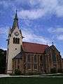 Hilter, church: Sankt Johannes der Täufer
gollark: It's reasonably short, captures the osmarks.tk™ spirit™, and does not place me at the mercy of Lichtenstein or something
gollark: How does osmw.org sound as an apiowebsite™ domain?
gollark: Yes, but only the first one of those.
gollark: I might want a mildly novelty one like a stupidly short (3-char + TLD one, it's available) domain, or [RANDOM VAGUELY COOL WORD].org.
gollark: If I were to get something like that it would be osmarks.org, yes.
References
External links
| Wikimedia Commons has media related to Hilter am Teutoburger Wald. |
- http://www.hilter.de Official website (German)
| Authority control |
|
|---|
This article is issued from Wikipedia. The text is licensed under Creative Commons - Attribution - Sharealike. Additional terms may apply for the media files.