Heiranglwa
Heiranglwa is a village in the Peren district of Nagaland, India. It is located in the Tening Circle.[1]
Heiranglwa | |
|---|---|
village | |
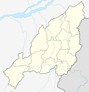 Heiranglwa Location in Nagaland, India  Heiranglwa Heiranglwa (India) | |
| Coordinates: 25.424817°N 93.610097°E | |
| Country | India |
| State | Nagaland |
| District | Peren |
| Circle | Tening |
| Population (2011) | |
| • Total | 476 |
| Time zone | UTC+5:30 (IST) |
| Census code | 268372 |
Demographics
According to the 2011 census of India, Heiranglwa has 107 households. The effective literacy rate (i.e. the literacy rate of population excluding children aged 6 and below) is 68.51%.[2]
| Total | Male | Female | |
|---|---|---|---|
| Population | 476 | 237 | 239 |
| Children aged below 6 years | 41 | 25 | 16 |
| Scheduled caste | 0 | 0 | 0 |
| Scheduled tribe | 476 | 237 | 239 |
| Literates | 298 | 151 | 147 |
| Workers (all) | 341 | 158 | 183 |
| Main workers (total) | 303 | 142 | 161 |
| Main workers: Cultivators | 297 | 140 | 157 |
| Main workers: Agricultural labourers | 2 | 0 | 2 |
| Main workers: Household industry workers | 0 | 0 | 0 |
| Main workers: Other | 4 | 2 | 2 |
| Marginal workers (total) | 38 | 16 | 22 |
| Marginal workers: Cultivators | 5 | 1 | 4 |
| Marginal workers: Agricultural labourers | 15 | 7 | 8 |
| Marginal workers: Household industry workers | 9 | 2 | 7 |
| Marginal workers: Others | 9 | 6 | 3 |
| Non-workers | 135 | 79 | 56 |
gollark: It doesn't actually have vim either.
gollark: Oh hypermemetic beeoids, what sort of horrible system doesn't even have *nano*?
gollark: Does anyone know some Android developers, by any chance? Because ææææææææææææÆÆÆÆÆÆÆÆÆÆÆÆÆÆÆæææÆÆÆÆÆÆÆÆÆæææÆÆÆÆÆa all is bee.
gollark: ```console=tty0 console=ttyS0,921600n1 vmalloc=400M slub_debug=OFZPU page_owner=on swiotlb=noforce androidboot.hardware=mt6765 maxcpus=8 loop.max_part=7 firmware_class.path=/vendor/firmware has_battery_removed=0 androidboot.boot_devices=bootdevice,11230000.mmc root=/dev/ram androidboot.verifiedbootstate=orange bootopt=64S3,32N2,64N2 androidboot.selinux=permissive buildvariant=eng androidboot.meta_log_disable=0 lpddr_used_index=2 prize_ddr_hardinfo= hall_up_cali_data=-16-16-16 hall_down_cali_data=-16-16-16 printk.disable_uart=1 bootprof.pl_t=4627 bootprof.lk_t=6878 bootprof.logo_t=619 androidboot.serialno=3082SH1001014876 androidboot.bootreason=kernel_panic gpt=1 usb2jtag_mode=0 mrdump_ddrsv=yes mrdump_cb=0x10e800,0x1400 androidboot.dtb_idx=0 androidboot.dtbo_idx=0```The kernel command line is quite something.
gollark: Based on the unhelpfulness of the internet I *may* actually have managed to create an entirely new class of horrible Android issue.
References
- "Nagaland revenue village directory" (PDF). Archived from the original (PDF) on 4 March 2016. Retrieved 22 July 2015.
- "District Census Handbook - Peren" (PDF). 2011 Census of India. Directorate of Census Operations, Nagaland. Retrieved 22 July 2015.
This article is issued from Wikipedia. The text is licensed under Creative Commons - Attribution - Sharealike. Additional terms may apply for the media files.