Heeze-Leende
Heeze-Leende (Dutch pronunciation: [ˌɦeːzə ˈleːndə] (![]()
Heeze-Leende | |
|---|---|
 | |
 Flag  Coat of arms | |
.svg.png) Location in North Brabant | |
| Coordinates: 51°23′N 5°35′E | |
| Country | Netherlands |
| Province | North Brabant |
| Established | 1 January 1997[1] |
| Government | |
| • Body | Municipal council |
| • Mayor | Paul Verhoeven (VVD) |
| Area | |
| • Total | 105.04 km2 (40.56 sq mi) |
| • Land | 104.00 km2 (40.15 sq mi) |
| • Water | 1.04 km2 (0.40 sq mi) |
| Elevation | 23 m (75 ft) |
| Population (January 2019)[5] | |
| • Total | 15,964 |
| • Density | 154/km2 (400/sq mi) |
| Time zone | UTC+1 (CET) |
| • Summer (DST) | UTC+2 (CEST) |
| Postcode | 5590–5595, 6029 |
| Area code | 040 |
| Website | www |
The spoken language is "Heeze-en-Leendes", a distinct dialect within the East Brabantian dialect group and is very similar to colloquial Dutch.
Population centres
Topography
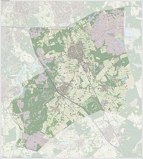
Dutch Topographic map of the municipality of Heeze-Leende, June 2015
Notable people
- Jan Moninckx (ca.1656 in Leende - 1714) a Dutch botanical artist and painter
- Laurentius Nicolaas Deckers (1883 in Heeze – 1978) a Dutch politician, diplomat and agronomist.
- Thomas Horsten (born 1994 in Heeze) a Dutch professional footballer
Gallery
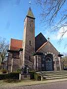 Catharinakerk, Beukenlaan, Sterksel
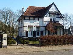 Pastoor Thijsenlaan, Sterksel
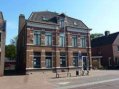 Jan Deckersstraat, Heeze
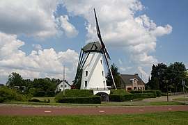 Molen, Sint Victor Geldrop
gollark: I shall have to add this to my viewing queue tomorrow.
gollark: Seems like an excellent place to go unless you have any networked computing devices ever.
gollark: Sounds fun.
gollark: At the very least they've almost certainly got the same technical capability, so someone somewhere is probably using it for evilness.
gollark: I wonder if UK carriers have similar services.
References
- "Gemeentelijke indeling op 1 januari 1997" [Municipal divisions on 1 January 1997]. cbs.nl (in Dutch). CBS. Retrieved 28 May 2014.
- "Wie is wie" [Who is who] (in Dutch). Gemeente Heeze-Leende. Archived from the original on 14 October 2013. Retrieved 28 May 2014.
- "Kerncijfers wijken en buurten" [Key figures for neighbourhoods]. CBS Statline (in Dutch). CBS. 2 July 2013. Retrieved 12 March 2014.
- "Postcodetool for 5591HS". Actueel Hoogtebestand Nederland (in Dutch). Het Waterschapshuis. Archived from the original on 21 September 2013. Retrieved 28 May 2014.
- "Bevolkingsontwikkeling; regio per maand" [Population growth; regions per month]. CBS Statline (in Dutch). CBS. 1 January 2019. Retrieved 1 January 2019.
External links

- Official website
Places adjacent to Heeze-Leende | ||||||||||
|---|---|---|---|---|---|---|---|---|---|---|
| ||||||||||

| Authority control |
|
|---|
This article is issued from Wikipedia. The text is licensed under Creative Commons - Attribution - Sharealike. Additional terms may apply for the media files.