Haaren, North Brabant
Haaren (![]()
Haaren | |
|---|---|
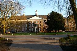
 Former seminary Haarendael in Haaren | |
 Flag Coat of arms | |
.svg.png) Location in North Brabant | |
| Coordinates: 51°36′N 5°14′E | |
| Country | Netherlands |
| Province | North Brabant |
| Government | |
| • Body | Municipal council |
| • Mayor | Yves de Boer (acting) (VVD) |
| Area | |
| • Total | 58.56 km2 (22.61 sq mi) |
| • Land | 57.72 km2 (22.29 sq mi) |
| • Water | 0.84 km2 (0.32 sq mi) |
| Elevation | 8 m (26 ft) |
| Population (January 2019)[3] | |
| • Total | 14,195 |
| • Density | 246/km2 (640/sq mi) |
| Time zone | UTC+1 (CET) |
| • Summer (DST) | UTC+2 (CEST) |
| Postcode | 5074–5076, 5268, 5296 |
| Area code | 013, 0411 |
| Website | www |
Haaren is known as 'The Garden of Brabant' because of the many plantations of trees, plants etc. The municipality of Haaren contains three other villages: Helvoirt, Esch, and Biezenmortel. An unusual thing about Haaren is that it belongs to two regions, Tilburg and 's-Hertogenbosch.
Population centres
(Population in 2003)
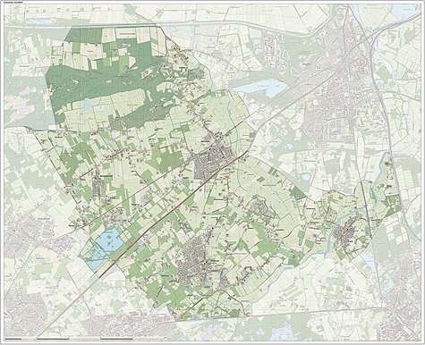
Topography

Dutch topographic map of the municipality of Haaren, June 2015
gollark: I see. I've never heard that before, but it does seem a possibility.
gollark: > Pigeonholing is a process that attempts to classify disparate entities into a small number of categories.according to the internet but I assume it's something more specific.
gollark: What's pigeonholing?
gollark: I'm not convinced that this will actually be useful outside of Google.
gollark: I feel like I would be more secure with a non-wireless-capable card, but I have no idea if my bank even offers those.
References
- "Kerncijfers wijken en buurten" [Key figures for neighbourhoods]. CBS Statline (in Dutch). CBS. 2 July 2013. Retrieved 12 March 2014.
- "Postcodetool for 5076AV". Actueel Hoogtebestand Nederland (in Dutch). Het Waterschapshuis. Retrieved 28 May 2014.
- "Bevolkingsontwikkeling; regio per maand" [Population growth; regions per month]. CBS Statline (in Dutch). CBS. 1 January 2019. Retrieved 1 January 2019.
External links

- Official website
This article is issued from Wikipedia. The text is licensed under Creative Commons - Attribution - Sharealike. Additional terms may apply for the media files.
