Hawke's Bay District Health Board
The Hawke's Bay District Health Board (Hawke's Bay DHB or HBDHB) is a district health board with the focus on providing healthcare to an area in the Hawke's Bay Region of New Zealand.
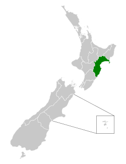 Location of the Hawke's Bay DHB (green) in New Zealand | |
| Abbreviation | HBDHB |
|---|---|
| Formation | 1 January 2001 |
| Founder | New Zealand Government |
| Legal status | Active |
| Purpose | DHB |
| Services | Health and disability services |
Parent organization | Ministry of Health |
| Website | hawkesbay |
History
The Hawke's Bay District Health Board, like most other district health boards, came into effect on 1 January 2001 established by the New Zealand Public Health and Disability Act 2000.[1]
Geographic area
The area covered by the Hawke's Bay District Health Board is defined in Schedule 1 of the New Zealand Public Health and Disability Act 2000 and based on territorial authority and ward boundaries as constituted as at 1 January 2001. The area initially identified was Tauranga District,[lower-alpha 1] Western Bay of Plenty District, Whakatane District, Kawerau District, and Ōpōtiki District.[2] The area can be adjusted through an Order in Council,[3] which happened on 27 April 2001, by clause 7 of the Health (Constituencies of District Health Boards) Order 2001, when Mayor Island / Tuhua and Motiti Island were added to the area.[4]
Governance
The initial board was fully appointed. Since the 2001 local elections, the board has been partially elected (seven members) and in addition, up to four members get appointed by the Minister of Health. The minister also appoints the chairperson and deputy-chair from the pool of eleven board members.[5]
Demographics
| Year | Pop. | ±% p.a. |
|---|---|---|
| 2006 | 147,639 | — |
| 2013 | 151,092 | +0.33% |
| 2018 | 166,287 | +1.94% |
| Source: [6] | ||
Hawke's Bay DHB served a population of 166,287 at the time of the 2018 New Zealand census, an increase of 15,195 people (10.1%) since the 2013 census, and an increase of 18,648 people (12.6%) since the 2006 census. There were 60,204 households. There were 81,003 males and 85,284 females, giving a sex ratio of 0.95 males per female. Of the total population, 34,926 people (21.0%) were aged up to 15 years, 29,175 (17.5%) were 15 to 29, 71,799 (43.2%) were 30 to 64, and 30,384 (18.3%) were 65 or older. Figures may not add up to the total due to rounding.
Ethnicities were 75.0% European/Pākehā, 27.0% Māori, 5.6% Pacific peoples, 5.0% Asian, and 1.7% other ethnicities. People may identify with more than one ethnicity.
The percentage of people born overseas was 15.9, compared with 27.1% nationally.
Although some people objected to giving their religion, 48.5% had no religion, 37.4% were Christian, and 7.2% had other religions.
Of those at least 15 years old, 21,408 (16.3%) people had a bachelor or higher degree, and 27,621 (21.0%) people had no formal qualifications. The median income was $28,300. The employment status of those at least 15 was that 63,951 (48.7%) people were employed full-time, 19,596 (14.9%) were part-time, and 4,710 (3.6%) were unemployed.[6]
Footnotes
- Note that between 1989 and 2003, the area now known as Tauranga City was Tauranga District
Notes
- Rudman, Brian (13 February 2012). "Brian Rudman: Three health boards must marry and economise". The New Zealand Herald. Retrieved 3 May 2020.
- Public Health and Disability Act 2000, Schedule 1.
- Public Health and Disability Act 2000, Section 19.
- Health (Constituencies of District Health Boards) Order 2001, Parliamentary Counsel Office, 2001, retrieved 4 May 2020
- "District health boards". Ministry of Health. 12 February 2020. Retrieved 3 May 2020.
- "Statistical area 1 dataset for 2018 Census". Statistics New Zealand. March 2020. Hawke's Bay DHB (10).
References
- New Zealand Public Health and Disability Act 2000, Parliamentary Counsel Office, 2000, retrieved 3 May 2020