Hawai, Arunachal Pradesh
Hawai is the district headquarters of the newly created Anjaw District in the state of Arunachal Pradesh in north-east India.
Hawai | |
|---|---|
Town | |
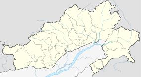 Hawai Location in Arunachal Pradesh, India  Hawai Hawai (India) | |
| Coordinates: 27°53′7″N 96°48′37″E | |
| Country | |
| State | Arunachal Pradesh |
| Languages | |
| • Official | English |
| Time zone | UTC+5:30 (IST) |
| Vehicle registration | AR |
Location
It is located at an altitude of 1296 m above sea level on the banks of the Lohit River, a tributary of the Brahmaputra River.[1]
Etymology
"Hawai" in Kaman Mishmi dialect means "Pond". The Mishmi are the main ethnic tribe in Anjaw District.[1]
Transport
The 2,000-kilometre-long (1,200 mi) proposed Mago-Thingbu to Vijaynagar Arunachal Pradesh Frontier Highway along the McMahon Line,[2][3][4][5] (will intersect with the proposed East-West Industrial Corridor Highway) and will pass through this district, alignment map of which can be seen here and here.[6]
Media
Hawai has an All India Radio Relay station known as Akashvani Hawai. It broadcasts on FM frequencies.
See also
| Topics |
|
|---|---|
| Administration |
|
| Divisions |
|
| Districts | |
| Major Towns |
|
| Historical Places | |
Portal: India | |
| States | |
|---|---|
| Union territories | |
| |
External links
References
- "Anjaw District". Archived from the original on 14 November 2006. Retrieved 27 October 2006.
- "Top officials to meet to expedite road building along China border". Dipak Kumar Dash. timesofindia.indiatimes.com. Retrieved 27 October 2014.
- "Narendra Modi government to provide funds for restoration of damaged highways". =dnaindia.com. Retrieved 27 October 2014.
- "Indian Government Plans Highway Along Disputed China Border". Ankit Panda. thediplomat.com. Retrieved 27 October 2014.
- "Govt planning road along McMohan line in Arunachal Pradesh: Kiren Rijiju". Live Mint. Retrieved 26 October 2014.
- "China warns India against paving road in Arunachal". Ajay Banerjee. tribuneindia.com. Retrieved 26 October 2014.
Places adjacent to Hawai, Arunachal Pradesh | ||||||||||
|---|---|---|---|---|---|---|---|---|---|---|
| ||||||||||