Haslet, Texas
Haslet is a city in mostly Tarrant County and partly in Denton County within the Dallas–Fort Worth metroplex in the U.S. state of Texas, and is located 15 miles north of downtown Fort Worth and 20 miles south of Denton. Haslet borders Interstate 35W, U.S. Highway 287, and Alliance Airport.
City of Haslet | |
|---|---|
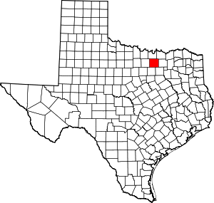
 Location of Haslet in Tarrant County, Texas | |
| Coordinates: 32°57′35″N 97°20′24″W | |
| Country | |
| State | |
| Counties | Tarrant, Denton |
| Government | |
| • Type | Council-Manager |
| • City Council | Mayor Bob Golden Kathleen Golden (First Lady) Mitch Hill Kathy Hopper Harold Williams Patricia Hilborn |
| • City Manager | James Quin |
| Area | |
| • Total | 8.94 sq mi (23.16 km2) |
| • Land | 8.93 sq mi (23.12 km2) |
| • Water | 0.02 sq mi (0.05 km2) |
| Elevation | 702 ft (214 m) |
| Population (2010) | |
| • Total | 1,517 |
| • Estimate (2019)[2] | 1,923 |
| • Density | 215.44/sq mi (83.18/km2) |
| Time zone | UTC-6 (CST) |
| • Summer (DST) | UTC-5 (CDT) |
| ZIP code | 76052 |
| Area code(s) | 817 |
| FIPS code | 48-32720[3] |
| GNIS feature ID | 1337443[4] |
| Website | Haslet, TX |
History
According to the Handbook of Texas, the area was settled around 1880, but likely no distinct community formed until 1883, when the tracks of the Gulf, Colorado and Santa Fe Railway were extended through the area. Haslett, Michigan, was the hometown of the railroad's contractor. A post office opened in 1887; by 1896, the one-teacher school had 21 students. Haslet's population was 67 in 1903 and 50 in 1915. During the 1920s, Haslet had three grocery stores, a hardware store, a dry goods store, and a cotton gin.[5]
Geography
Haslet is located at 32°57′35″N 97°20′24″W (32.959733, -97.340028).[6]
According to the United States Census Bureau, the town has a total area of 8.2 square miles (21.2 km2), of which 0.02 square miles (0.05 km2), or 0.22%, is water.[7] Haslet is 702 ft. above sea level.
Climate
The climate in this area is characterized by hot, humid summers and generally mild to cool winters. According to the Köppen climate classification, Haslet has a humid subtropical climate, Cfa on climate maps.[8]
| Haslet, Texas | ||||||||||||||||||||||||||||||||||||||||||||||||||||||||||||
|---|---|---|---|---|---|---|---|---|---|---|---|---|---|---|---|---|---|---|---|---|---|---|---|---|---|---|---|---|---|---|---|---|---|---|---|---|---|---|---|---|---|---|---|---|---|---|---|---|---|---|---|---|---|---|---|---|---|---|---|---|
| Climate chart (explanation) | ||||||||||||||||||||||||||||||||||||||||||||||||||||||||||||
| ||||||||||||||||||||||||||||||||||||||||||||||||||||||||||||
| ||||||||||||||||||||||||||||||||||||||||||||||||||||||||||||
| Climate data for Haslet, Texas | |||||||||||||
|---|---|---|---|---|---|---|---|---|---|---|---|---|---|
| Month | Jan | Feb | Mar | Apr | May | Jun | Jul | Aug | Sep | Oct | Nov | Dec | Year |
| Record high °F (°C) | 86 (30) |
90 (32) |
95 (35) |
100 (38) |
102 (39) |
108 (42) |
109 (43) |
112 (44) |
112 (44) |
99 (37) |
89 (32) |
90 (32) |
112 (44) |
| Average high °F (°C) | 65.3 (18.5) |
67.4 (19.7) |
73.0 (22.8) |
78.1 (25.6) |
83.3 (28.5) |
88.2 (31.2) |
91.1 (32.8) |
92.2 (33.4) |
87.3 (30.7) |
81.1 (27.3) |
72.3 (22.4) |
66.0 (18.9) |
92.4 (33.6) |
| Average low °F (°C) | 28.0 (−2.2) |
30.6 (−0.8) |
38.5 (3.6) |
50.5 (10.3) |
59.2 (15.1) |
73.8 (23.2) |
77.5 (25.3) |
76.9 (24.9) |
64.7 (18.2) |
50.8 (10.4) |
37.1 (2.8) |
28.8 (−1.8) |
23.5 (−4.7) |
| Average precipitation inches (mm) | 2.12 (54) |
2.09 (53) |
3.09 (78) |
3.60 (91) |
3.96 (101) |
4.12 (105) |
2.28 (58) |
2.33 (59) |
2.71 (69) |
3.33 (85) |
2.05 (52) |
1.93 (49) |
33.61 (854) |
| Average snowfall inches (cm) | 0.3 (0.76) |
0.3 (0.76) |
0.3 (0.76) |
0.0 (0.0) |
0.0 (0.0) |
0.0 (0.0) |
0.0 (0.0) |
0.0 (0.0) |
0.0 (0.0) |
0.0 (0.0) |
0.1 (0.25) |
1.4 (3.6) |
2.4 (6.13) |
| Average precipitation days (≥ 0.01 in) | 6 | 6 | 8 | 7 | 9 | 7 | 6 | 4 | 6 | 7 | 5 | 6 | 77 |
| Average snowy days (≥ 0.1 in) | 0 | 2 | 1 | 0 | 0 | 0 | 0 | 0 | 0 | 0 | 0 | 1 | 4 |
| Source: National Weather Service Forecast Office, Ft Worth Alliance Airport, Fort Worth TX | |||||||||||||
Demographics
| Historical population | |||
|---|---|---|---|
| Census | Pop. | %± | |
| 1970 | 276 | — | |
| 1980 | 262 | −5.1% | |
| 1990 | 795 | 203.4% | |
| 2000 | 1,134 | 42.6% | |
| 2010 | 1,517 | 33.8% | |
| Est. 2019 | 1,923 | [2] | 26.8% |
| U.S. Decennial Census[9] | |||
As of the census[3] of 2010, 1,517 people, 533 households, and 454 families resided in the town. The population density was 151.2 people per square mile (58.4/km2). The 533 housing units averaged 53.6 per square mile (20.7/km2). The racial makeup of the city was 84.7% White, 0.5% Native American, 1.6% Asian, 2.8% from other races, and 1.9% from two or more races. Hispanics or Latinos of any race were 8.5% of the population. Males made up 51.3% of the population and females, 48.7%.
Of the 533 households, 40% had children under the age of 18 living with them, 75.8% were married couples living together, 4.9% had a female householder with no husband present, and 14.8% were not families. The average household size was 2.85 and the average family size was 3.1. The median age was 43.1 years.
According to Applied Geographic Solutions in 2012, the population had grown to 1,593 and total dwellings had increased to 566. About 45.4% of each household had an income of $100,000 or more with 71% making $60,000 or more. The median household income was $90,356. About 36.26% of the population had a bachelor's degree or higher; 93% had at least a high school education. Home values averaged $249,200. Owner-occupied housing units were 93.1%.
In 2010, the Gadberry Group named Haslet as one of the top-10 most notable areas in the country for growth.[10]
Economic growth
Considered a major intermodal hub, Haslet has a transportation and distribution network via major highways, BNSF Railway Intermodel and nearby Alliance Airport.[11] Dallas Fort Worth International Airport is 30 minutes away.
Haslet's primary trade area was 605,917 in 2015 and is expected to grow to 675,018 by 2019.[12] With a build-out of only 20% of available sites, Haslet is positioning itself to attract new corporations and businesses. Haslet offers a property tax rate of 33 cents per $100.[13]
Other corporate distribution/warehouse centers in Haslet include:
- Amazon Fulfillment Center
- International Aviation Composites (IAC)
- Coca-Cola Company
- Exel, Inc.
- FedEx Freight
- KFS, Inc.
- Michael's
- SC Johnson & Son, Inc.
- Volkswagen
- Williamson-Dickie
- Kraft
Living in Haslet
The City of Haslet provides a safe, rural setting for families. Haslet's award-winning Northwest Independent School District , low crime rate and dedicated fire department make the city attractive for families. Haslet's Sports Association presents an impressive array of organized sports. Annual events include:
- Haslet Hustle
- Halloween Haunted Hayride
- Christmas Tree Lighting
- Wild West Fest and Rodeo
- Annual Independence Day Celebration
- National Night Out Community Event
References
- "2019 U.S. Gazetteer Files". United States Census Bureau. Retrieved August 7, 2020.
- "Population and Housing Unit Estimates". United States Census Bureau. May 24, 2020. Retrieved May 27, 2020.
- "U.S. Census website". United States Census Bureau. Retrieved 2008-01-31.
- "US Board on Geographic Names". United States Geological Survey. 2007-10-25. Retrieved 2008-01-31.
- Handbook of Texas, History of Haslet
- "US Gazetteer files: 2010, 2000, and 1990". United States Census Bureau. 2011-02-12. Retrieved 2011-04-23.
- "Geographic Identifiers: 2010 Demographic Profile Data (G001): Haslet city, Texas". United States Census Bureau. Retrieved November 30, 2011.
- Climate Summary for Haslet, Texas
- "Census of Population and Housing". Census.gov. Retrieved June 4, 2015.
- "The Gadberry Group Top 10". Archived from the original on 26 April 2012. Retrieved 10 September 2013.
- http://www.allianceairport.com/
- "Haslet Retail Analysis and Merchandising Plan" (PDF). Retrieved 19 May 2017.
- "Haslet, TX Economic Development". February 2018.

