Hartwell, Northamptonshire
Hartwell is a village and civil parish in South Northamptonshire, bordering Buckinghamshire. The village is next to Salcey Forest and the M1 motorway. It is 7 miles (11 km) south of Northampton and 13 miles (21 km) north of Milton Keynes.
| Hartwell | |
|---|---|
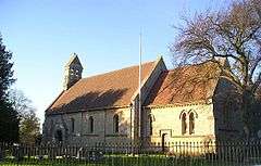 St John the Baptist Parish Church Hartwell built ca 1851 | |
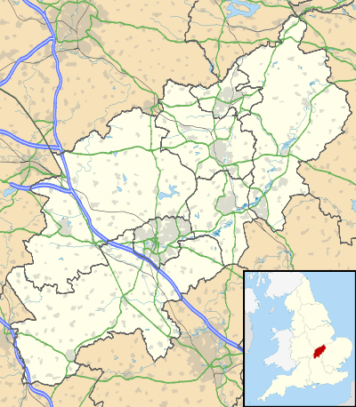 Hartwell Location within Northamptonshire | |
| Population | 1,815 [1] 1,875 (2011 census)[2] |
| OS grid reference | SP7850 |
| • London | 62 miles (100 km) |
| Civil parish |
|
| District | |
| Shire county | |
| Region | |
| Country | England |
| Sovereign state | United Kingdom |
| Post town | NORTHAMPTON |
| Postcode district | NN7 |
| Dialling code | 01604 |
| Police | Northamptonshire |
| Fire | Northamptonshire |
| Ambulance | East Midlands |
| UK Parliament | |
Demographics
According to the 2001 census, the parish had a population of 1,815 people in 693 household,.[1] increasing to 1,875 at the 2011 census.[3] Men in the Salcey ward had the fifth highest life expectancy at birth, 89.3 years, of any ward in England and Wales in 2016.[4]
Within the village are Hartwell Parish Church, Hartwell CofE Primary School, the Rose and Crown public house, community centre, recreational ground, village shop and Conservative Club.
Hartwellians
- Isaac Wake (1580–1632), diplomat, political commentator, and ambassador of the Court of St James's to Savoy and France
gollark: That would ruin my brand.
gollark: What do you want me to do, alter the colors?
gollark: It is CLEARLY hyperbolic geometry, yes.
gollark: This is NOT true. I have not in any way been sponsored by pizza companies. There have been no advertising agreements whatsoever with any companies producing pizza or otherwise to have me subliminally advertise pizza, as my profile picture is not a pizza. Since it is not a pizza, this is obviously not pizza advertisement whatsoever. No monetary exchanges or otherwise have occurred with companies engaged in pizza production for any reason relating to my profile picture. You are clearly engaged in libel and attempting to discredit my non-pizza-advertising status. It is IN NO WAY subliminal pizza advertising because I DO NOT work for pizza companies in any form. It's not pizza. There were no deals, under-the-table or otherwise, with pizza companies. No pizza companies pay for any kind of subliminal advertising involving me. People make that mistake, but I am not working for pizza companies doing subliminal advertising; that is not in any way what I am doing. I am NOT being sponsored by ANY pizza companies to display subliminal pizza advertising OF ANY KIND.
gollark: It is NOT a pizza.
References
- Office for National Statistics: Hartwell CP: Parish headcounts. Retrieved 12 November 2009
- SNC (2011). South Northamptonshire Council Year Book 2011–2012. Towcester NN12 7FA. p. 39.CS1 maint: location (link)
- "Civil Parish 2011". Neighbourhood Statistics. Office for National Statistics. Retrieved 5 July 2016.
- Bennett, James; et al. (22 November 2018). "Contributions of diseases and injuries to widening life expectancy inequalities in England from 2001 to 2016: a population-based analysis of vital registration data". Lancet public health. Retrieved 23 November 2018.
This article is issued from Wikipedia. The text is licensed under Creative Commons - Attribution - Sharealike. Additional terms may apply for the media files.