Haralson, Georgia
Haralson is a town in Coweta and Meriwether counties in the U.S. state of Georgia. The population was 166 at the 2010 census.[5] It is noted for being one of the filming locations for both The Walking Dead and Lawless.
Haralson, Georgia | |
|---|---|
 Location in Coweta County and the state of Georgia | |
| Coordinates: 33°13′36″N 84°34′11″W | |
| Country | United States |
| State | Georgia |
| Counties | Coweta, Meriwether |
| Area | |
| • Total | 0.79 sq mi (2.04 km2) |
| • Land | 0.78 sq mi (2.01 km2) |
| • Water | 0.01 sq mi (0.03 km2) |
| Elevation | 837 ft (255 m) |
| Population (2010) | |
| • Total | 166 |
| • Estimate (2019)[2] | 192 |
| • Density | 246.79/sq mi (95.31/km2) |
| Time zone | UTC-5 (Eastern (EST)) |
| • Summer (DST) | UTC-4 (EDT) |
| ZIP code | 30229 |
| Area code(s) | 770 |
| FIPS code | 13-36528[3] |
| GNIS feature ID | 0356164[4] |
History
The first permanent settlement at Haralson was made in the 1820s.[6] Haralson was named for Hugh A. Haralson, a former Georgia congressman, who is also the namesake of Haralson County, Georgia.[7]
The Georgia General Assembly incorporated the place as the Town of Haralson in 1907.[8]
Geography
Haralson is located primarily in southeastern Coweta County at 33°13′36″N 84°34′11″W.[9] The city limits extend slightly south into Meriwether County.
According to the United States Census Bureau, the town has a total area of 0.81 square miles (2.1 km2), of which 0.012 square miles (0.03 km2), or 1.40%, is water.[5]
Demographics
| Historical population | |||
|---|---|---|---|
| Census | Pop. | %± | |
| 1890 | 114 | — | |
| 1910 | 174 | — | |
| 1920 | 176 | 1.1% | |
| 1930 | 133 | −24.4% | |
| 1940 | 108 | −18.8% | |
| 1950 | 142 | 31.5% | |
| 1960 | 141 | −0.7% | |
| 1970 | 162 | 14.9% | |
| 1980 | 123 | −24.1% | |
| 1990 | 139 | 13.0% | |
| 2000 | 144 | 3.6% | |
| 2010 | 166 | 15.3% | |
| Est. 2019 | 192 | [2] | 15.7% |
| U.S. Decennial Census[10] | |||
As of the census[3] of 2000, there were 144 people, 57 households, and 200 families residing in the town. The population density was 203.1 people per square mile (78.3/km2). There were 65 housing units at an average density of 91.7 per square mile (35.3/km2). The racial makeup of the town was 84.03% White, 6.94% African American, 1.39% Asian, and 7.64% from two or more races.
There were 57 households, out of which 26.3% had children under the age of 18 living with them, 61.4% were married couples living together, 8.8% had a female householder with no husband present, and 24.6% were non-families. 21.1% of all households were made up of individuals, and 5.3% had someone living alone who was 65 years of age or older. The average household size was 2.53 and the average family size was 2.91.
In the town, the population was spread out, with 23.6% under the age of 18, 9.0% from 18 to 24, 31.9% from 25 to 44, 24.3% from 45 to 64, and 11.1% who were 65 years of age or older. The median age was 37 years. For every 100 females, there were 100.0 males. For every 100 females age 18 and over, there were 103.7 males.
The median income for a household in the town was $37,500, and the median income for a family was $39,167. Males had a median income of $33,750 versus $23,125 for females. The per capita income for the town was $16,346. There were 9.5% of families and 13.8% of the population living below the poverty line, including 25.8% of under eighteens and 33.3% of those over 64.
References
- "2019 U.S. Gazetteer Files". United States Census Bureau. Retrieved July 9, 2020.
- "Population and Housing Unit Estimates". United States Census Bureau. May 24, 2020. Retrieved May 27, 2020.
- "U.S. Census website". United States Census Bureau. Retrieved 2008-01-31.
- "US Board on Geographic Names". United States Geological Survey. 2007-10-25. Retrieved 2008-01-31.
- "Geographic Identifiers: 2010 Demographic Profile Data (G001): Haralson town, Georgia". U.S. Census Bureau, American Factfinder. Archived from the original on February 12, 2020. Retrieved July 31, 2014.
- Krakow, Kenneth K. (1975). Georgia Place-Names: Their History and Origins (PDF). Macon, GA: Winship Press. p. 103. ISBN 0-915430-00-2.
- Gannett, Henry (1905). The Origin of Certain Place Names in the United States. Govt. Print. Off. pp. 149.
- Acts and Resolutions of the General Assembly of the State of Georgia. Clark & Hines, State Printers. 1907. p. 694.
- "US Gazetteer files: 2010, 2000, and 1990". United States Census Bureau. 2011-02-12. Retrieved 2011-04-23.
- "Census of Population and Housing". Census.gov. Retrieved June 4, 2015.
| Wikimedia Commons has media related to Haralson, Georgia. |
Municipalities and communities of Coweta County, Georgia, United States | ||
|---|---|---|
| Cities | 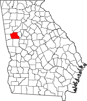 Map of Georgia highlighting Coweta County | |
| Towns | ||
| CDP | ||
| Unincorporated communities |
| |
| Footnotes | ‡This populated place also has portions in an adjacent county or counties | |
Municipalities and communities of Meriwether County, Georgia, United States | ||
|---|---|---|
| Cities | 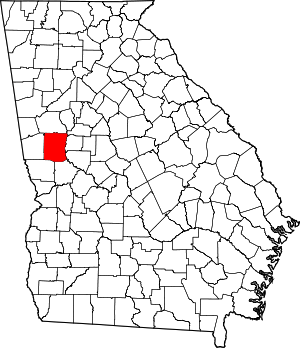 Map of Georgia highlighting Meriwether County | |
| Towns | ||
| Unincorporated communities | ||
| Footnotes | ‡This populated place also has portions in an adjacent county or counties | |