Happy Valley, New Mexico
Happy Valley is an unincorporated community and census-designated place in Eddy County, New Mexico, United States. Its population was 519 as of the 2010 census.[1] The community is located on the western edge of Carlsbad; New Mexico State Road 524 passes through the area. The town was settled as a farming community before potash was manufactured here. It was named because the lack of land use regulations made residents happy.[3]
Happy Valley, New Mexico | |
|---|---|
 Happy Valley | |
| Coordinates: 32°25′26″N 104°17′27″W | |
| Country | United States |
| State | New Mexico |
| County | Eddy |
| Area | |
| • Total | 2.159 sq mi (5.59 km2) |
| • Land | 2.156 sq mi (5.58 km2) |
| • Water | 0.003 sq mi (0.008 km2) |
| Elevation | 3,209 ft (978 m) |
| Population | |
| • Total | 519 |
| • Density | 240/sq mi (93/km2) |
| Time zone | UTC-7 (Mountain (MST)) |
| • Summer (DST) | UTC-6 (MDT) |
| Area code(s) | 575 |
| GNIS feature ID | 2584108[2] |
Geography
Happy Valley is located at 32.423909°N 104.290790°W. According to the U.S. Census Bureau, the community has an area of 2.159 square miles (5.59 km2), of which 2.156 square miles (5.58 km2) are land and 0.003 square miles (0.0078 km2) are water.[1]
gollark: They do. They have more hydrogen, but "burn" it more rapidly.
gollark: Bigger stars live for less time.
gollark: Actually, no.
gollark: Wait, no, I have a solution: add lots of extra mass very fast so it goes supernova and does NOT go red.
gollark: But red dwarves eventually become blue dwarves or something, apparently... I think it's something with having more helium?
References
- "2010 Census Gazetteer Files - Places: New Mexico". U.S. Census Bureau. Retrieved December 7, 2015.
- "Happy Valley Census Designated Place". Geographic Names Information System. United States Geological Survey.
- Julyan, Robert (1996). The Place Names of New Mexico. University of New Mexico Press. p. 161. ISBN 0826316891.
Municipalities and communities of Eddy County, New Mexico, United States | ||
|---|---|---|
| Cities | 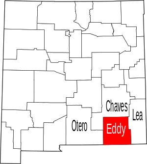 Map of New Mexico highlighting Eddy County | |
| Villages | ||
| CDPs | ||
| Unincorporated communities | ||
This article is issued from Wikipedia. The text is licensed under Creative Commons - Attribution - Sharealike. Additional terms may apply for the media files.