Hannibal, Ohio
Hannibal is a census-designated place in eastern Ohio Township, Monroe County, Ohio, United States.[2] Although it is unincorporated, it has a post office, with the ZIP code of 43931.[3] As of the 2016 estimate, it had a population of 451.[4]
Hannibal, Ohio | |
|---|---|
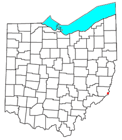 Location of Hannibal, Ohio | |
| Coordinates: 39°40′7″N 80°52′25″W | |
| Country | United States |
| State | Ohio |
| County | Monroe |
| Area | |
| • Total | 1.1 sq mi (2.9 km2) |
| • Land | 1.1 sq mi (2.9 km2) |
| • Water | 0.0 sq mi (0.0 km2) |
| Elevation | 680 ft (210 m) |
| Population (2010) | |
| • Total | 451 |
| • Density | 400/sq mi (160/km2) |
| Time zone | UTC-5 (Eastern (EST)) |
| • Summer (DST) | UTC-4 (EDT) |
| ZIP code | 43931 |
| GNIS feature ID | 2628898[1] |
Hannibal lies along Ohio State Route 7 near an intersection with Ohio State Route 536. An Ohio River town, it is home to the Hannibal Locks and Dam. The town lies below Powhatan Point and above Sardis. Hannibal is also connected to New Martinsville, West Virginia via the New Martinsville Bridge.
Hannibal is served by the Switzerland of Ohio Local School District, and is home to Hannibal Elementary School and River High School.
Geography
Hannibal is located at 39°40′7″N 80°52′25″W (39.6718, -80.8741). According to the United States Census Bureau, the CDP has a total area of 1.1 square miles (2.9 km2), all of it land.[5]
References
- "US Board on Geographic Names". United States Geological Survey. 2007-10-25. Retrieved 2008-01-31.
- U.S. Geological Survey Geographic Names Information System: Hannibal, Ohio
- Zip Code Lookup
- "Profile of General Population and Housing Characteristics: 2010 Demographic Profile Data (DP-1): Hannibal CDP, Ohio". United States Census Bureau. Retrieved June 4, 2012.
- "Geographic Identifiers: 2010 Demographic Profile Data (G001): Hannibal CDP, Ohio". United States Census Bureau. Retrieved June 4, 2012.
Municipalities and communities of Monroe County, Ohio, United States | ||
|---|---|---|
| Villages | 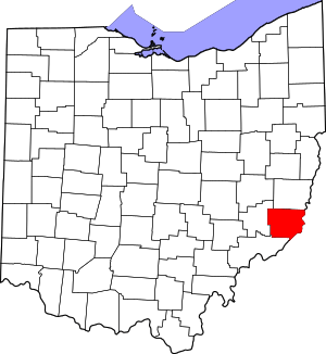 Map of Ohio highlighting Monroe County | |
| Townships | ||
| CDPs | ||
| Unincorporated communities | ||
| Ghost town | ||
| Footnotes | ‡This populated place also has portions in an adjacent county or counties | |
| Authority control |
|
|---|