Hanjiang District, Yangzhou
![]()
Hanjiang 邗江区 | |
|---|---|
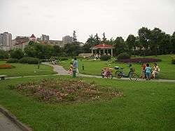 Park at the intersection of Wenchang West Road (文昌西路) and Weiyang Road (维扬路; 維揚路) | |
 Hanjiang Location in Jiangsu | |
| Coordinates: 32°26′42″N 119°24′00″E[1] | |
| Country | People's Republic of China |
| Province | Jiangsu |
| Prefecture-level city | Yangzhou |
| Elevation | 9 m (28 ft) |
| Time zone | UTC+8 (China Standard) |
| Website | www |
In the past, the northern part of Yangzhou's main urban area constituted a separate Weiyang District, but in the late 2011 Weiyang District was abolished and merged into Hanjiang District.
Administrative divisions
Hanjiang District is divided into 10 subdistricts, 10 towns, and three townships:[2]
Subdistricts:
- Hanshang Subdistrict (邗上街道), Xinsheng Subdistrict (新盛街道), Jiangwang Subdistrict (蒋王街道), Chahe Subdistrict (汊河街道), Shuangqiao Subdistrict (双桥街道), Meiling Subdistrict (梅岭街道), Ganquan Subdistrict (甘泉街道), Shouxihu Subdistrict (瘦西湖街道), Yangzijin Subdistrict (扬子津街道), Wenhui Subdistrict (文汇街道)
Towns:
- Gongdao (公道镇), Fangxiang (方巷镇), Huaisi (槐泗镇), Guazhou (瓜洲镇), Touqiao (头桥镇), Yangshou (杨寿镇), Tai'an (泰安镇), Yangmiao (杨庙镇), Xihu (西湖镇), Puxi (朴席镇)
Townships:
- Pingshan Township (平山乡), Shuangqiao Township (双桥乡), Chengbei Township (城北乡)
Gallery
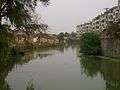 A residential area near the Thin West Lake and the Baozhang Lake
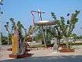 A public plaza near RT-Mart on Yangzhou's west side
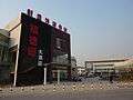 Xinsheng Subdistrict
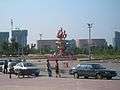
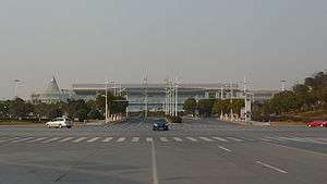 Yangzhou Railway Station on the Nanjing–Qidong Railway
References
| Wikimedia Commons has media related to Hanjiang District. |
- www.xzqh.org (in Chinese)
- Google (2014-07-02). "Hanjiang" (Map). Google Maps. Google. Retrieved 2014-07-02.
- 2011年统计用区划代码和城乡划分代码:邗江区 (in Chinese). National Bureau of Statistics of the People's Republic of China. Retrieved 2013-01-04.
External links