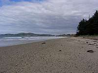
Hampden, New Zealand
Hampden, a small town[1] in North Otago, New Zealand, lies close to the North Otago coast, 35 kilometres south of Oamaru and 80 kilometres north of the city of Dunedin, to both of which it is connected by State Highway 1.

The township's population at its largest was about 560, but by 2009 it had dwindled to approximately 230.[2] Hampden is named in honour of the English politician John Hampden by early surveyor W. B. D. Mantell, possibly influenced by the location of a public house, The Hampden Hotel, at the site.[3]
Geography

Hampden is situated beside a broad bay stretching from Aorere Point to Moeraki Point, on a coastal plain which rises westward to the foothills of the Horse Range and the Kakanui Range. The soil of this surrounding plain overlies a limestone formation.[4] The Moeraki Boulders are located two kilometres south of Hampden.[5] Much of the town lies between the Big Kuri (Kurinui) and Little Kuri Creeks.
The streets of Hampden run in a rectangular grid pattern centred on the main highway and the railway. They are named after English locations, such as Lancaster, Shrewsbury, Worcester, and Norfolk. There is surfing on the Katiki straight, as well as trout-fishing in the Waianakarua and Shag Rivers.
History
The settlement was founded in the 1860s, with the first sale of land sections dated to March 1863. By 1865, there were two public houses in the area, The Hampden Hotel and The Clyde Hotel, and both a cemetery and mechanics' institute were in place by 1870. early industry in the area included the harvesting of flax and timber.[6]
A borough was proclaimed in 1879, with the first mayor being William Murcott.[6] The borough existed until the 1960s, and Hampden is now part of the Waitaki District.[2]
Modern Hampden
The town includes a rural fire station, a fish-and-chip shop, a small supermarket, a motel, and backpackers, a popular camping ground, a cafe, the Hampden Lodge and mechanics workshop, a small second-hand goods shop, a tavern, and a historic town hall. Sheep farming is the primary economic activity of the region and is augmented by farming of other livestock.
The Hampden Energy Forum, established in 2007, has grown into a community self-help scheme that involves nearly everyone in the settlement, growing from a small group of enthusiasts who were concerned about the future of small rural communities in "post-oil" days. At the inaugural meeting to establish the Forum, more than one third of the town's population attended. The forum won the Trustpower Community Award in 2008.
References
- "Place name detail: Hampden". New Zealand Gazetteer. Land Information New Zealand. Retrieved 29 May 2007.
- Rae, S. "Hampden set to mark 130 years as township," Otago Daily Times, 22 October 2009. Retrieved 20 April 2018.
- Reed, A.W. (1975) Place names of New Zealand. Wellington: A.H. & A.W. Reed. p.159
- Davis, Brian N.; Dollimore, Edward S. "Hampden". Te Ara – the encyclopedia of New Zealand (1966). Retrieved 20 April 2018.
- Peter Dowling (editor) (2004). Reed New Zealand Atlas. Reed Books. pp. map 102. ISBN 0-7900-0952-8.CS1 maint: extra text: authors list (link)
- Moore, C.W.S., (1958) Northern Approaches. Christchuch: Whitcombe & Tombs. pp. 115–6
External links
- "Hampden," entry from the 1905 Cyclopedia of New Zealand.