Ham-Sud, Quebec
Prior to October 22, 2011 it was a parish municipality and its name was Saint-Joseph-de-Ham-Sud.[4] It lies 20 kilometres (12 mi) to the east of Wotton and about 50 kilometres (31 mi) to the southwest of Thetford Mines. Quebec Route 257 passes through the region.
Ham-Sud | |
|---|---|
Municipality | |
.jpg) | |
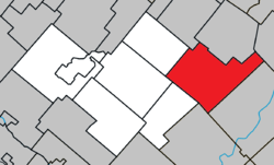 Location within Les Sources RCM | |
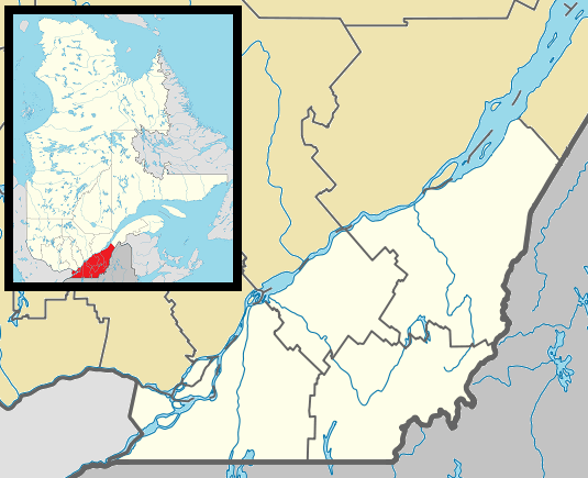 Ham-Sud Location in southern Quebec | |
| Coordinates: 45°45′N 71°36′W[1] | |
| Country | |
| Province | |
| Region | Estrie |
| RCM | Les Sources |
| Constituted | January 1, 1879 |
| Government | |
| • Mayor | Langevin Gagnon |
| • Federal riding | Richmond—Arthabaska |
| • Prov. riding | Richmond |
| Area | |
| • Total | 152.40 km2 (58.84 sq mi) |
| • Land | 152.85 km2 (59.02 sq mi) |
| There is an apparent contradiction between two authoritative sources | |
| Population (2016)[3] | |
| • Total | 235 |
| • Density | 1.6/km2 (4/sq mi) |
| • Pop 2006-2011 | |
| Time zone | UTC−5 (EST) |
| • Summer (DST) | UTC−4 (EDT) |
| Postal code(s) | J0B 3J0 |
| Area code(s) | 819 |
| Highways | |
| Website | ham-sud |
Ham-Sud is a municipality in Quebec, Canada.
Toponymy
Colonized in the middle of the 19th century, the township of Ham-Sud, established in 1851, takes its name from a village in the county of Essex in England. One of its first inhabitants, Joseph Dion, would eventually see his first name honoured through attribution to the mission in 1869. The parish was established both canonically and civilly in 1877. The parish municipality, installed two years later, would also take this denomination, Saint-Joseph-de-Ham-Sud.[5]
Demography
The 2016 census counted 235 inhabitants, which is a 4.4% increase from 2011.[6]
History
On 22 Oct. 2011, the parish municipality of Saint-Joseph-de-Ham-Sud changed its name and status to simply Municipality of Ham-Sud.[7]
References
- Reference number 359444 of the Commission de toponymie du Québec (in French)
- Geographic code 40005 in the official Répertoire des municipalités (in French)
- "(Code 2440005) Census Profile". 2011 census. Statistics Canada. 2012.
- http://www.stat.gouv.qc.ca/publications/referenc/pdf2011/modif_oct11.pdf%5B%5D
- "Toponymie : Saint-Joseph-de-Ham-Sud" (in French).
- Government of Canada, Statistics Canada (2017-02-08). "Census Profile, 2016 Census - Ham-Sud, Municipalité [Census subdivision], Quebec and Quebec [Province]". www12.statcan.gc.ca. Retrieved 2019-12-11.
- "Modifications aux municipalités du Québec" (PDF) (in French). Institut de la statistique du Québec. October 2011. p. 3. ISSN 1715-6408.
External links

- Official website(in French)
Places adjacent to Ham-Sud, Quebec | ||||||||||
|---|---|---|---|---|---|---|---|---|---|---|
| ||||||||||
| Cities | |
|---|---|
| Municipalities | |
| Townships | |
| |
| Authority control |
|
|---|