Hôrka
Hôrka (Slovak pronunciation: [ˈɦʊ̯ɔɾka]) is a village and municipality in Poprad District in the Prešov Region of northern Slovakia.[1]
Hôrka | |
|---|---|
Municipality | |
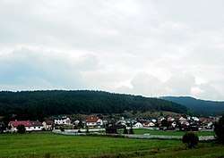 | |
 Hôrka Location of Hôrka in Slovakia | |
| Coordinates: 49°01′17″N 20°23′35″E | |
| Country | Slovakia |
| Region | Prešov |
| District | Poprad |
| Founded | 1347 |
| Area | |
| • Total | 11.305999 km2 (4.365271 sq mi) |
| Elevation | 600 m (2,000 ft) |
| Population (31 December 2010) | |
| • Total | 1,778 |
| • Density | 160/km2 (410/sq mi) |
| Postal code | 059 12 |
| Area code(s) | +421-52 |
| Car plate | PP |
| Website | www.horka.eu/ |
Geography
The municipality lies at an altitude of 610 metres and covers an area of 11.305 km². It has a population of about 1560 people.
History
In historical records the village was first mentioned in 1347.
Economy and infrastructure
Near the village is a wind park. From cultural sightseeings are interesting early gothic Roman Catholic church and a baroque chapel.
gollark: RNNs with attentions, which is of course ridiculous because attention is all you need.
gollark: Huh, the coral translator thing™ actually does use RNNs and not transformers?
gollark: We may convert you into Cauchy sequences at random.
gollark: In what way?
gollark: Also me.
References
- "Statistical Office of the Slovak Republic" (PDF). Výsledky SODB 2011. Štatistický úrad SR. Archived from the original (PDF) on October 12, 2013. Retrieved 9 August 2012.
Genealogical resources
The records for genealogical research are available at the state archive "Statny Archiv in Levoca, Slovakia"
External links
- https://web.archive.org/web/20160801155048/http://horka.e-obce.sk/
- Surnames of living people in Horka
Municipalities of Poprad District | ||
|---|---|---|
This article is issued from Wikipedia. The text is licensed under Creative Commons - Attribution - Sharealike. Additional terms may apply for the media files.