Grover Hill, Ohio
Grover Hill is a village in Paulding County, Ohio, United States. The population was 402 at the 2010 census. The village is named after President Grover Cleveland.
Grover Hill, Ohio | |
|---|---|
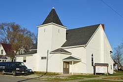 Bible Baptist Church | |
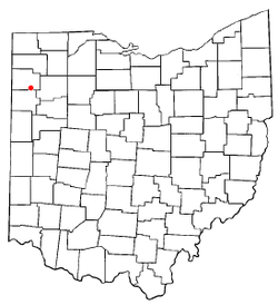 Location of Grover Hill, Ohio | |
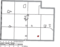 Location of Grover Hill in Paulding County | |
| Coordinates: 41°1′7″N 84°28′37″W | |
| Country | United States |
| State | Ohio |
| County | Paulding |
| Township | Latty |
| Government | |
| • Mayor | John E. Moon |
| Area | |
| • Total | 0.28 sq mi (0.71 km2) |
| • Land | 0.28 sq mi (0.71 km2) |
| • Water | 0.00 sq mi (0.00 km2) |
| Elevation | 722 ft (220 m) |
| Population | |
| • Total | 402 |
| • Estimate (2019)[4] | 376 |
| • Density | 1,362.32/sq mi (525.91/km2) |
| Time zone | UTC-5 (Eastern (EST)) |
| • Summer (DST) | UTC-4 (EDT) |
| ZIP code | 45849 |
| Area code(s) | 419 |
| FIPS code | 39-32620[5] |
| GNIS feature ID | 1064773[2] |
Geography
Grover Hill is located at 41°01′07″N 84°28′37″W.[6]
According to the United States Census Bureau, the village has a total area of 0.28 square miles (0.73 km2), all land.[7]
Demographics
| Historical population | |||
|---|---|---|---|
| Census | Pop. | %± | |
| 1900 | 655 | — | |
| 1910 | 676 | 3.2% | |
| 1920 | 530 | −21.6% | |
| 1930 | 414 | −21.9% | |
| 1940 | 478 | 15.5% | |
| 1950 | 463 | −3.1% | |
| 1960 | 547 | 18.1% | |
| 1970 | 536 | −2.0% | |
| 1980 | 486 | −9.3% | |
| 1990 | 518 | 6.6% | |
| 2000 | 412 | −20.5% | |
| 2010 | 402 | −2.4% | |
| Est. 2019 | 376 | [4] | −6.5% |
| U.S. Decennial Census[8] | |||
2010 census
As of the census[3] of 2010, there were 402 people, 159 households, and 110 families residing in the village. The population density was 1,435.7 inhabitants per square mile (554.3/km2). There were 183 housing units at an average density of 653.6 per square mile (252.4/km2). The racial makeup of the village was 98.5% White, 0.2% African American, and 1.2% from two or more races. Hispanic or Latino of any race were 1.0% of the population.
There were 159 households, of which 34.6% had children under the age of 18 living with them, 52.2% were married couples living together, 12.6% had a female householder with no husband present, 4.4% had a male householder with no wife present, and 30.8% were non-families. 25.8% of all households were made up of individuals, and 11.3% had someone living alone who was 65 years of age or older. The average household size was 2.53 and the average family size was 3.03.
The median age in the village was 37.1 years. 28.6% of residents were under the age of 18; 7.4% were between the ages of 18 and 24; 22.4% were from 25 to 44; 26.6% were from 45 to 64; and 14.9% were 65 years of age or older. The gender makeup of the village was 51.0% male and 49.0% female.
2000 census
As of the census[5] of 2000, there were 412 people, 167 households, and 115 families residing in the village. The population density was 1,420.4 people per square mile (548.5/km2). There were 183 housing units at an average density of 630.9 per square mile (243.6/km2). The racial makeup of the village was 96.12% White, 0.49% African American, 0.24% Native American, 0.73% from other races, and 2.43% from two or more races. Hispanic or Latino of any race were 2.43% of the population.
There were 167 households, out of which 31.7% had children under the age of 18 living with them, 55.7% were married couples living together, 11.4% had a female householder with no husband present, and 31.1% were non-families. 28.7% of all households were made up of individuals, and 12.6% had someone living alone who was 65 years of age or older. The average household size was 2.47 and the average family size was 2.97.
In the village, the population was spread out, with 26.0% under the age of 18, 7.8% from 18 to 24, 29.1% from 25 to 44, 21.8% from 45 to 64, and 15.3% who were 65 years of age or older. The median age was 37 years. For every 100 females there were 93.4 males. For every 100 females age 18 and over, there were 95.5 males.
The median income for a household in the village was $33,750, and the median income for a family was $41,667. Males had a median income of $31,563 versus $22,222 for females. The per capita income for the village was $14,872. About 11.5% of families and 17.7% of the population were below the poverty line, including 31.0% of those under age 18 and 8.8% of those age 65 or over.
History
Grover Hill was a boom town, created as a stop on the railroad. 'The Depot' restaurant gives homage to the town's beginnings. A comprehensive history of the town and nearby communities was self-published by Laurence R. Hipp, a longtime resident of Grover Hill.[9]
References
- "2019 U.S. Gazetteer Files". United States Census Bureau. Retrieved July 28, 2020.
- "US Board on Geographic Names". United States Geological Survey. 2007-10-25. Retrieved 2008-01-31.
- "U.S. Census website". United States Census Bureau. Retrieved 2013-01-06.
- "Population and Housing Unit Estimates". United States Census Bureau. May 24, 2020. Retrieved May 27, 2020.
- "U.S. Census website". United States Census Bureau. Retrieved 2008-01-31.
- "US Gazetteer files: 2010, 2000, and 1990". United States Census Bureau. 2011-02-12. Retrieved 2011-04-23.
- "US Gazetteer files 2010". United States Census Bureau. Archived from the original on 2012-01-24. Retrieved 2013-01-06.
- "Census of Population and Housing". Census.gov. Retrieved June 4, 2015.
- Hipp, Laurence R. 1971. History of Grover Hill (Latty and Washington Townships of Paulding County, Ohio). 393 pp.
Municipalities and communities of Paulding County, Ohio, United States | ||
|---|---|---|
| Villages |  Map of Ohio highlighting Paulding County | |
| Townships | ||
| Unincorporated communities | ||
| Footnotes | ‡This populated place also has portions in an adjacent county or counties | |
| Authority control |
|
|---|