Grinnell Glacier
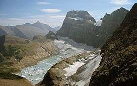
Grinnell Glacier is in the heart of Glacier National Park in the U.S. state of Montana. The glacier is named for George Bird Grinnell, an early American conservationist and explorer, who was also a strong advocate of ensuring the creation of Glacier National Park. The glacier is in the Lewis Range and rests on the north flank of Mount Gould at an altitude averaging 7,000 feet (2,100 m), in the Many Glacier region of the park.[3]
| Grinnell Glacier | |
|---|---|
 Grinnell Glacier in background (2005) | |
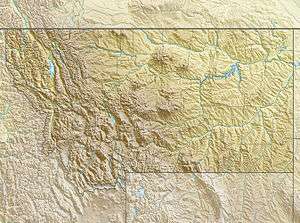
 Grinnell Glacier Location in Montana | |
| Type | Mountain Glacier |
| Location | Glacier National Park, Glacier County, Montana, U.S. |
| Coordinates | 48°45′06″N 113°43′39″W[1] |
| Area | 152 acres (0.62 km2) in 2005[2] |
| Terminus | Proglacial lake |
| Status | Retreating |
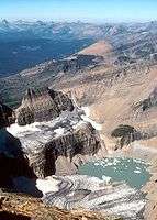
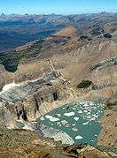
The glacier has been one of the most photographed glaciers in the park and many of these photographs date back to the mid 19th century during the late Little Ice Age. When compared with images taken over subsequent years, the glacier has obviously retreated substantially. In 1850, Grinnell Glacier measured 710 acres (2.9 km2), including the area of The Salamander Glacier, an ice apron or shelf glacier that used to be attached to Grinnell, but is now separate. By 1993, Grinnell Glacier measured 220 acres (0.89 km2) and The Salamander measured 57 acres (0.23 km2).[4]
Between 1966 and 2005, Grinnell Glacier lost almost 40 percent of its acreage.[2] Glaciologists have predicted that if carbon dioxide levels increase at a worst-case scenario, all the glaciers in the park, including Grinnell, will disappear by the year 2030.[5][6] However, under a modest increase in overall carbon dioxide levels, some glaciers will remain until the year 2277.[6]
Gem Glacier, one of the smallest remaining glaciers in the park, is located on the Garden Wall above Grinnell. Repeat photography taken between the years 1938 and 2009 (as shown below) show that Grinnell Glacier has retreated significantly over that period. The Salamander and Gem Glaciers have shown little change in area over the same period of time. The Salamander receives its name for its shape and its coloring, which comes from the serratia bacteria that grows on it.
The glacier can be reached after a 6-mile (9.7 km) hike from a trailhead beginning at Swiftcurrent Lake. The trail has an altitude gain of just over 1,600 ft (490 m), with the majority of that in the second half of the hike.[7]


.jpg)
|
See also
- Retreat of glaciers since 1850
- List of glaciers in the United States
- Glaciers in Glacier National Park (U.S.)
References
- "Grinnell Glacier". Geographic Names Information System. United States Geological Survey. Retrieved 2013-02-09.
- "Retreat of Glaciers in Glacier National Park" (PDF). United States Geological Survey. 2010. Archived from the original (PDF) on 2012-05-11. Retrieved 2013-02-09.
- Many Glacier, MT (Map). TopoQwest (United States Geological Survey Maps). Retrieved 2013-02-09.
- Key, Carl H.; Daniel B. Fagre; Richard K. Menicke. "Glacier Retreat in Glacier National Park, Montana" (PDF). Glaciers of the Conterminous United States. U.S. Geological Survey. Archived from the original (PDF) on 2013-02-25. Retrieved 2013-02-09.
- "Monitoring and Assessing Glacier Changes and Their Associated Hydrologic and Ecologic Effects in Glacier National Park". Glacier Monitoring Studies. U.S. Geological Survey. 2012. Archived from the original on 2013-02-18. Retrieved 2013-02-09.
- Hall, Myrna H.P.; Daniel B. Fagre (February 2003). "Modeled Climate-Induced Glacier Change in Glacier National Park, 1850–2100". BioScience. 53 (2): 131–140. doi:10.1641/0006-3568(2003)053[0131:mcigci]2.0.co;2.
- "Grinnell Glacier Trail". Big Sky Fishing. Retrieved 2013-02-09.
| Wikimedia Commons has media related to Grinnell Glacier. |


