Grau Province
Grau Province is one of the seven provinces of the Apurímac Region in Peru. The capital of the province is the city of Chuquibambilla.
Grau | |
|---|---|
 Flag | |
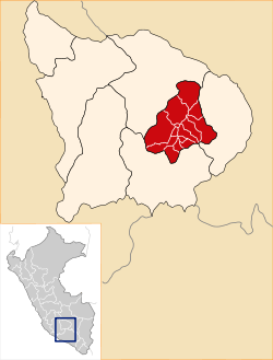
 Location of Grau in the Apurímac Region | |
| Country | Peru |
| Region | Apurímac |
| Capital | Chuquibambilla |
| Area | |
| • Total | 2,174.52 km2 (839.59 sq mi) |
| Population | |
| • Total | 27,574 |
| • Density | 13/km2 (33/sq mi) |
| UBIGEO | 0307 |
The province was named after the naval officer Miguel Grau Seminario.
Boundaries
- North: Abancay Province
- East: Cotabambas Province
- South: Antabamba Province
- West: Abancay Province
Geography
One of the highest peaks of the district is Q'urawiri at approximately 5,000 m (16,000 ft). Other mountains are listed below:[1]
- Allqa Q'awa
- Alma Pampa
- Amayani
- Anta Marka
- Aqu Qucha
- Aqu Q'asa
- Asiru Pata
- Awkirana
- Challa Q'asa
- Chunta Q'asa
- Ch'uspi
- Hatun Qaqa
- Ikma
- Intikancha
- Kachi Kutana
- Kawsu
- Kimsaqucha
- Kuta Wasi
- Llamayuq Rumi
- Misa Pata
- Pampa Urqu
- Parqa Urqu
- Pinqulluni
- Puka Qaqa
- Pukara
- Puma Wasi
- Qiwllanka
- Qutani
- Q'ara Pata
- Q'illu
- Q'illu Q'asa
- Q'illuni
- Rumi Urqu
- Saywit'u
- Surani
- Suwa Qullu
- Taya Q'asa
- Tika Pallana
- Uywaki
- Waman Ch'arpa
- Waman Marka
- Waqutu
- Wayunkani
- Wik'uña Kunka
- Winq'u Pata
- Yana Urqu
- Yawriwiri
Political division
The province measures 2,174.52 square kilometres (839.59 sq mi) and is divided into fourteen districts:
Ethnic groups
The people in the province are mainly indigenous citizens of Quechua descent. Quechua is the language which the majority of the population (81.28%) learnt to speak in childhood, 18.17% of the residents started speaking using the Spanish language and 0.22% using Aymara (2007 Peru Census).[2]
gollark: USB 2 goes to 480Mbps. This is 60MB/s.
gollark: Which is something like a twentieth of a decent HDD's write speed.
gollark: My USB 3 one can manage an *impressive* 5MB/s or so.
gollark: But they're generally horrible and big.
gollark: `greenery` can do the complement/inverse of regexes, at least.
Sources
- escale.minedu.gob.pe/ UGEL map Grau Province (Apurimac Region)
- inei.gob.pe Archived 2013-01-27 at the Wayback Machine INEI, Peru, Censos Nacionales 2007
This article is issued from Wikipedia. The text is licensed under Creative Commons - Attribution - Sharealike. Additional terms may apply for the media files.