Goraya
Goraya is a city in Jalandhar district and Tehsil in the Indian state of Punjab. It lies between Phagwara and Phillaur stretch of National Highway 44 (Old NH 1), Grand Trunk Road.
Goraya | |
|---|---|
City | |
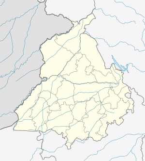
 Goraya Location in Punjab, India  Goraya Goraya (India) | |
| Coordinates: 31.13°N 75.77°E | |
| Country | India |
| State | Punjab |
| District | Jalandhar |
| Tehsil | Phillaur |
| Government | |
| • Body | Nagar Palika |
| Population (2011) | |
| • Total | 16,462 8,657/7,805♂/♀ |
| • Total Households | 3,590 |
| Languages | |
| • Official | Punjabi |
| Time zone | UTC+5:30 (IST) |
| PIN | 144409 |
| Telephone code | 01826 |
| Vehicle registration | PB 37 |
Demography
As of 2011, the town has a total number of 3590 houses and the population of 16,462 of which include 8,657 are males while 7,805 are females. According to the report published by Census India in 2011, out of the total population of the village 4,864 people are from Schedule Caste and the village does not have any Schedule Tribe population so far.[1]
Geography
Goraya is located at 31.13°N 75.77°E. It has an average elevation of 240 metres (790 ft). The town has a humid subtropical climate with cool winters and hot summers. Summers last from April to June and winters from November to February. Temperatures in summer vary from average highs of around 44 °C (111 °F) to average lows of around 25 °C (77 °F). Winter temperatures vary from highs of 19 °C (66 °F) to lows of −5 °C (23 °F). On the whole, the climate is dry except during the brief southwest monsoon season during July–August. The average annual rainfall is about 70 centimetres (28 in).
Education and religion
There are various government and public schools and colleges in Goraya S.H.I.P.S, SR. Sec govt schools, and some other private schools have been doing well as a medium of providing education to children of the area. There are places for worshipping like mandirs, dargah and gurudwaras.
References
- "Population as of 2011". Census of India, 2011.