Google Street View in Chile
Google's Street View program in Chile began with the filming of streets and roads in January 2012. On September 25, 2012, parts of the country were made available online, including Santiago, Valparaíso, Viña del Mar and Concepción.[2] During 2013 and 2014 many more cities and roads were added. In March 2015 coverage was extended to the country's southernmost region of Magallanes (only accessible by road via Argentina). In December 2015 Chile's southernmost city, Puerto Williams, was added.
As of December 2015, coverage is high, with over seven-tenths of all cities —or over three-quarters of the country's population— having most of its streets photographed.
Timeline of introductions
| Date | Major locations added |
|---|---|
| Tuesday, September 25, 2012 | Greater Santiago (including ski resorts), Greater Valparaíso (including Limache) and Greater Concepción.[3] |
| Thursday, June 13, 2013 | Tourist spots.[4] |
| Wednesday, August 14, 2013 | Arica, Iquique, Calama, San Pedro de Atacama, Antofagasta, Taltal, Chañaral, Caldera, Copiapó, Vallenar, La Serena, Coquimbo, Ovalle, Andacollo, Combarbalá, Illapel, Salamanca, San Felipe, Los Andes, Quintero, Quillota, Concón, Casablanca, San Antonio, Rancagua, Curicó, Talca, Linares, Los Ángeles, Nacimiento, Temuco, Osorno, Puerto Varas, Puerto Montt, Calbuco, Ancud, Coyhaique, Aysén, Cochrane, expanded coverage of Greater Santiago and more locations. |
| Monday, April 21, 2014 | Angol, Contulmo, Collipulli, Los Sauces, Traiguen, Victoria, Galvarino, Temuco, Villarrica, Pucón, Curarrehue, Chanco, Cobquecura, Constitución, Melipilla, Santa Cruz, Panguipulli, Lanco, Mariquina, Valdivia, Paillaco, Castro, Quellón and more locations. |
| Wednesday, June 4, 2014 | More locations. |
| Wednesday, January 21, 2015 | More locations, including Pichilemu and Bulnes, and expanded coverage of existing locations. |
| Friday, March 6, 2015 | Punta Arenas, Puerto Natales, and hamlet of Cerro Castillo. |
| Tuesday, April 7, 2015 | Roads around Torres del Paine National Park. |
| Tuesday, May 19, 2015 | Expanded coverage of existing locations, including, Santa María, Lo Miranda, Loncoche, Pitrufquén, and Victoria. |
| Monday, June 8, 2015 | Expanded coverage of existing locations, including, Curanilahue, La Unión, Machalí, Tocopilla, Cañete, La Laja, Río Bueno, Nueva Imperial, Vicuña, Cabrero, Graneros, and Panguipulli. |
| Wednesday, December 2, 2015 | Puerto Williams, and expanded coverage of existing locations, including, Puerto Aisén, Pucón, Hualqui, Quinta de Tilcoco, and Monte Patria. |
Coverage
Coverage as of December 2015 in cities, which account for 83% of the country's total population:
| Coverage | Settlements | Population | % |
|---|---|---|---|
| High | 171 | 11,467,782 | 91.45 |
| Medium | 27 | 611,478 | 4.88 |
| Low | 30 | 344,492 | 2.75 |
| None | 11 | 115,526 | 0.92 |
| Cities | 239 | 12,539,278 | 100.00 |
| Other settlements | 36,978 | 2,577,157 | 17.05 |
| Total population (2002) | 37,217 | 15,116,435 | 100.00 |
See also
- Google Street View in Latin America
References
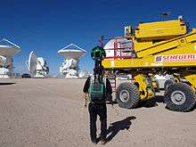
- "All ESO's Observatories Included in Google Street View". ESO Announcement. Retrieved 11 June 2014.
- "Google Lat Long: Introducing Imagery of Chile and Croatia on Google Maps". Google-latlong.blogspot.co.uk. 2012-09-26. Retrieved 2013-01-19.
- "Google Lat Long: Introducing Imagery of Chile and Croatia on Google Maps". Google-latlong.blogspot.com. 2012-09-26. Retrieved 2013-01-19.
- Yick, Deanna (2013-06-13). "Google Lat Long: Experience 1,001 New Destinations with Street View". Google-latlong.blogspot.com. Retrieved 2013-07-01.
External links
- About Street View: Current driving locations and areas presently available.
| Related products |
| ||||
|---|---|---|---|---|---|
| Views and mapping sites | |||||
| Street View |
| ||||
| Other | |||||